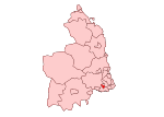
Gosforth
Districts of Newcastle upon TyneFormer civil parishes in Tyne and WearUnparished areas in Tyne and WearUse British English from July 2015Wards of Newcastle upon Tyne

Gosforth is an affluent suburb of the city and metropolitan borough of Newcastle upon Tyne, England. It constituted a separate urban district from 1895 until 1974 before officially merging with the city of Newcastle upon Tyne. In 2001, it had a population of 23,620.There are four electoral wards on Newcastle City Council that include parts of Gosforth: Dene and South Gosforth, Fawdon and West Gosforth, Gosforth, and Parklands. Gosforth is located to the north of the city centre.
Excerpt from the Wikipedia article Gosforth (License: CC BY-SA 3.0, Authors, Images).Gosforth
Regent Road, Newcastle upon Tyne Gosforth
Geographical coordinates (GPS) Address Nearby Places Show on map
Geographical coordinates (GPS)
| Latitude | Longitude |
|---|---|
| N 55.007 ° | E -1.623 ° |
Address
Regent Road 2
NE3 1DX Newcastle upon Tyne, Gosforth
England, United Kingdom
Open on Google Maps


