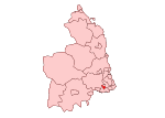
West Gosforth
Districts of Newcastle upon TyneUse British English from July 2015Wards of Newcastle upon Tyne
West Gosforth was an electoral ward in the north of Newcastle upon Tyne, Tyne and Wear, England. It was created in 2004 and abolished in 2018. The population of the ward is 9,681, increasing to 9,991 at the 2011 Census, 3.7% of the total population of Newcastle upon Tyne. Car ownership in the area is 78.1%, higher than the city average of 54.7%. Other wards in Gosforth include Gosforth, Dene and South Gosforth, Fawdon and West Gosforth, and Parklands (which includes northern Gosforth including Melton Park and Brunton Park).
Excerpt from the Wikipedia article West Gosforth (License: CC BY-SA 3.0, Authors).West Gosforth
Regent Farm Road, Newcastle upon Tyne Gosforth
Geographical coordinates (GPS) Address Nearby Places Show on map
Geographical coordinates (GPS)
| Latitude | Longitude |
|---|---|
| N 55.011 ° | E -1.622 ° |
Address
Regent Point
Regent Farm Road
NE3 3HD Newcastle upon Tyne, Gosforth
England, United Kingdom
Open on Google Maps


