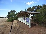
Penfield, South Australia
Penfield is a northern suburb of Adelaide, South Australia, in the City of Playford. William Penfold, one of the first settlers in the area, subdivided land he had bought in the Hundred of Munno Para in 1856 to create the township of Penfield. The area was commonly known as Peachey Belt or Peachy Belt. The boundaries have changed over the years, the original township being overshadowed by the government acquisition of land immediately south of the early town centre since the 1940s for construction of military facilities such as the Penfield munitions factory. As a result, much of the modern peri-urban locality of Penfield is used for industrial purposes rather than residential and the original town centre is no longer a population centre. The remaining part of the Zoar Bible Christian Church, built in 1855, is the small cemetery.
Excerpt from the Wikipedia article Penfield, South Australia (License: CC BY-SA 3.0, Authors).Penfield, South Australia
Womma Road, Adelaide Penfield
Geographical coordinates (GPS) Address Nearby Places Show on map
Geographical coordinates (GPS)
| Latitude | Longitude |
|---|---|
| N -34.68335 ° | E 138.62259 ° |
Address
Stop 77 Womma Road - North side
Womma Road
5121 Adelaide, Penfield
South Australia, Australia
Open on Google Maps
