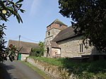
Barrow, Shropshire
Civil parishes in ShropshireShropshire geography stubsVillages in Shropshire

Barrow is a hamlet and civil parish in Shropshire, England, some 5 miles south of Telford between Ironbridge and Much Wenlock. Although Barrow itself consists of a church and just a few dwellings, the parish extends from Broseley to the eastern edge of Much Wenlock; it also includes the hamlets of Willey and Benthall, and the lost settlement of Caughley. According to the 2001 census the parish had a population of 636, increasing at the 2011 Census to 680. Barrow is a short distance south of the site of a lost mediaeval village, Arlescott. The Jack Mytton Way runs through both Arlescott and Barrow.
Excerpt from the Wikipedia article Barrow, Shropshire (License: CC BY-SA 3.0, Authors, Images).Barrow, Shropshire
B4376,
Geographical coordinates (GPS) Address Nearby Places Show on map
Geographical coordinates (GPS)
| Latitude | Longitude |
|---|---|
| N 52.597235 ° | E -2.506235 ° |
Address
B4376
TF12 5BW
England, United Kingdom
Open on Google Maps


