place

Birchmeadow Playing Fields

History of ShropshireIndustrial RevolutionIndustrial archaeologyParks and open spaces in Shropshire

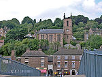
Birchmeadow Playing Field Site is a 5.3-hectare (13-acre) recreational area in Broseley, England, consisting of a mixture of woodland, play area, and a football pitch. It was also one of the first places where a wooden railway was built. The site is protected by Fields in Trust through a legal "Deed of Dedication" safeguarding the future of the space as public recreation land for future generations to enjoy.

Excerpt from the Wikipedia article Birchmeadow Playing Fields (License: CC BY-SA 3.0, Authors).

Birchmeadow Playing Fields
Birch Meadow,

Geographical coordinates (GPS) Address Nearby Places
placeShow on map

Wikipedia: Birchmeadow Playing FieldsContinue reading on Wikipedia

Geographical coordinates (GPS)

Latitude Longitude
N 52.6156 ° E -2.4816 °
placeShow on map

Address

Birch Meadow
TF12 5LT
England, United Kingdom
mapOpen on Google Maps

Share experience

Nearby Places

The Iron Bridge
The Iron Bridge

The Iron Bridge is a cast iron arch bridge that crosses the River Severn in Shropshire, England. Opened in 1781, it was the first major bridge in the world to be made of cast iron. Its success inspired the widespread use of cast iron as a structural material, and today the bridge is celebrated as a symbol of the Industrial Revolution. The geography of the deep Ironbridge Gorge, formed by glacial action during the last ice age, meant that there are industrially useful deposits of coal, iron ore, limestone and fire clay present near the surface where they are readily mined, but also that it was difficult to build a bridge across the river at this location. To cope with the instability of the banks and the need to maintain a navigable channel in the river, a single span iron bridge was proposed by Thomas Farnolls Pritchard. After initial uncertainty about the use of iron, construction took place over 2 years, with Abraham Darby III responsible for the ironworks. The bridge crosses the Ironbridge Gorge with a main span of 100 ft 6 in (30.63 m), allowing sufficient clearance for boats to pass underneath. In 1934 it was designated a scheduled monument and closed to vehicular traffic. Tolls for pedestrians were collected until 1950, when the bridge was transferred into public ownership. After being in a poor state of repair for much of its life, extensive restoration works in the latter half of the 20th century have protected the bridge. The bridge, the adjacent settlement of Ironbridge and the Ironbridge Gorge form the UNESCO Ironbridge Gorge World Heritage Site.