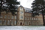
Woodlands, London
Woodlands is a small area located in the borough of Hounslow, London between Hounslow and Isleworth. It is an area roughly bounded by the Hounslow Loop railway line and the London Road to the north; the Duke of Northumberland's River and Twickenham Road to the east; and Bridge Road / Worton Road to the south and south-west. It includes roads such as Woodlands Road, Woodland Gardens, Woodlands Grove as well as The Woodlands Tavern public house and St John the Baptist's Church on St John's Road.The estate comprises mostly semi-detached houses built in the 1930s, although there are older buildings too. Before these houses were built the area was used as orchards, hence the name 'Woodlands'. There is an organisation known as the WERFA (Woodlands Estate Resident Freeholders Association) which has a community hall in the small private park in the centre of Woodland Gardens.
Excerpt from the Wikipedia article Woodlands, London (License: CC BY-SA 3.0, Authors).Woodlands, London
Morris Road, London Worton (London Borough of Hounslow)
Geographical coordinates (GPS) Address Nearby Places Show on map
Geographical coordinates (GPS)
| Latitude | Longitude |
|---|---|
| N 51.469568 ° | E -0.337465 ° |
Address
Morris Road
Morris Road
TW7 6JE London, Worton (London Borough of Hounslow)
England, United Kingdom
Open on Google Maps


