place

Southern Avenue (Washington, D.C.)

Southern United States road stubsStreets in Washington, D.C.Washington, D.C., geography stubsWashington, D.C., stubs
2016 09 11 11 26 33 View west at the west end of Maryland State Route 218 (Suitland Road) at Southern Avenue, crossing from Suitland, Prince Georges County, Maryland into Washington, D.C.

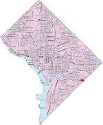
Southern Avenue is one of three boundary streets between Washington, D.C., and the state of Maryland. Following a southwest-to-northeast line, Southern Avenue begins at the intersection of South Capitol Street in Southeast, Washington, D.C., and Indian Head Highway on the Maryland side. It runs for approximately 7 miles (11 km) to its other end at Eastern Avenue in Northeast, Washington, D.C., with an uncompleted gap between Naylor Road SE and Branch Avenue SE. Southern Avenue was built in pieces. For example, the portion between Benning Road SE and 46th Street SE was not started until 1928. One of the first residential developments on Southern Avenue was Fairfield, a cluster of luxury homes at the intersection of Highview Terrace SE and 34th Street SE in the Summit Park neighborhood.The Southern Avenue bridge over Suitland Parkway was the first orthotropic deck girder bridge built in Washington, D.C.

Excerpt from the Wikipedia article Southern Avenue (Washington, D.C.) (License: CC BY-SA 3.0, Authors, Images).

Southern Avenue (Washington, D.C.)
Southern Avenue Southeast,

Geographical coordinates (GPS) Address Nearby Places
placeShow on map

Wikipedia: Southern Avenue (Washington, D.C.)Continue reading on Wikipedia

Geographical coordinates (GPS)

Latitude Longitude
N 38.856886111111 ° E -76.955408333333 °
placeShow on map

Address

Southern Avenue Southeast 3407
20746
Maryland, United States
mapOpen on Google Maps

2016 09 11 11 26 33 View west at the west end of Maryland State Route 218 (Suitland Road) at Southern Avenue, crossing from Suitland, Prince Georges County, Maryland into Washington, D.C.
Share experience

Nearby Places

Washington National Records Center

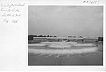
The Washington National Records Center (WNRC) in Suitland, Maryland, stores and references records of U.S. Federal agencies located in the District of Columbia, Maryland, Virginia and West Virginia.Physical records are transferred to WNRC when they are no longer needed by the respective agencies but have not met their scheduled retention period, including the records of the Federal Courts in DC and the Armed Forces. Those records remain at the WNRC until acceptance as permanent records by the National Archives, or else they are destroyed and recycled. The records are tracked individually in a database from the time they arrive at the WNRC. While court records are freely available to the public, the majority of records are controlled by their respective originating agency, and all records are subject to the access restrictions specific to that agency and national security classification. The WNRC encompasses approximately 789,000 square feet (73,300 m2) of space and has a capacity to hold over 3.9 million cubic feet (110,000 m3) of Federal records. Security systems, and fire suppression systems protect the records in the Center. Upon arrival, visitors to the Center must go through security, sign in, and present photo identification at the guard's station in the entrance lobby. In 2007, the WNRC opened a new Electronic Records Vault. The 976 square-foot vault allows Federal Records Centers to store and service temporary electronic records for Federal agencies. This was after a major criminal fire on Tuesday, 29 February 2000, which destroyed 700,000 pages, as reported by archives officials.

Skyland (Washington, D.C.)

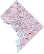
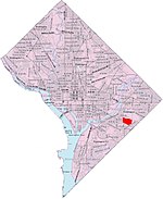
Skyland is a neighborhood in Southeast Washington, D.C. It is bounded by Good Hope Road to the northeast, Alabama Avenue to the southeast, and Fort Stanton Park to the south and west. It is part of Ward 8. Also see article on the Anacostia neighborhood. The District is in the midst of redeveloping the 18-acre (73,000 m2) Skyland Shopping Center at Alabama Avenue and Naylor Road, SE in Ward 7 into a mixed-used town center. The District is working with the Rappaport Cos. and the William S. Smith Cos. on a master plan for the site. Initial plans for Skyland Town Center call for more than 320,000 square feet (30,000 m2) of retail space—a combination of high-quality, large format national-brand retailers and neighborhood serving shops and restaurants. The project will also include 420 to 470 units of housing, about 80 percent of the units will be condos and 20 percent will be apartments. Several outstanding legal issues associated with the project have complicated the development process, but the District is working closely with the development team and its architects, Torti Gallas + Partners, to accelerate the pre-development work so the project moves on a parallel track with the legal process. The development team expects to have its master plan completed and a Planned Unit Development (PUD) application filed with the Zoning Commission by the spring of 2008. The District and development team are negotiating the business terms of their agreement. The DC Council has already approved a Tax Increment Financing (TIF) package to provide gap financing for the project. Skyland is within the Good Hope neighborhood and borders Hillcrest to the east and Naylor Gardens to the southeast.