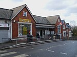
Upper Norwood

Upper Norwood is an area of south London, England, within the London Boroughs of Bromley, Croydon, Lambeth and Southwark. It is north of Croydon and the eastern part of it is better known as the Crystal Palace area. Upper Norwood is situated along the London clay ridge known as Beulah Hill. Most housing dates from the 19th and 20th centuries, with large detached properties along the ridge and smaller, semi-detached and terraced dwellings on the slopes. There are some more modern areas of social housing that date from the 1970s. The hill offers panoramic views northward to central London and southward to central Croydon and the North Downs.
Excerpt from the Wikipedia article Upper Norwood (License: CC BY-SA 3.0, Authors, Images).Upper Norwood
Central Hill, London West Norwood (London Borough of Croydon)
Geographical coordinates (GPS) Address Nearby Places Show on map
Geographical coordinates (GPS)
| Latitude | Longitude |
|---|---|
| N 51.4196 ° | E -0.0877 ° |
Address
Central Hill 65
SE19 1BS London, West Norwood (London Borough of Croydon)
England, United Kingdom
Open on Google Maps


