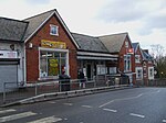
Gipsy Hill

Gipsy Hill in south London is a hilly neighbourhood spanning the southern parts of the London Boroughs of Lambeth and Southwark characterised for its great views of the City of London and Dulwich. Historically, north of its traditional Westow-Central Hill southern limit, it was split between the southern projections of the West Norwood daughter parish of Lambeth and the St Giles church daughter parish of Camberwell in Surrey until urban reforms of 1889 creating the County of London. It takes in, due to a diagonal, slightly weaving border, somewhat less of the London Borough of Southwark and has a ridge-top border along the retail/services/leisure street Westow Hill and residential street Central Hill with Upper Norwood in the London Borough of Croydon.
Excerpt from the Wikipedia article Gipsy Hill (License: CC BY-SA 3.0, Authors, Images).Gipsy Hill
Sainsbury Road, London West Norwood (London Borough of Lambeth)
Geographical coordinates (GPS) Address Nearby Places Show on map
Geographical coordinates (GPS)
| Latitude | Longitude |
|---|---|
| N 51.4245 ° | E -0.084 ° |
Address
Gipsy Hill
Sainsbury Road
SE19 1QL London, West Norwood (London Borough of Lambeth)
England, United Kingdom
Open on Google Maps


