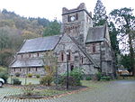
place

Betws-y-Coed railway station
1868 establishments in WalesBetws-y-CoedDfT Category F1 stationsFormer London and North Western Railway stationsPages with no open date in Infobox station
Railway stations in Conwy County BoroughRailway stations in Great Britain opened in 1868Railway stations served by Transport for Wales RailUse British English from February 2017
Betwsycoedsn
Betwsycoedsn

Betws-y-coed railway station is on the Conwy Valley Line, which runs between Llandudno and Blaenau Ffestiniog. It is situated 15+1⁄2 miles (24.9 km) south of Llandudno Junction. The passenger train service is operated by Transport for Wales Rail and is marketed as the Conwy Valley Railway (Welsh: Rheilffordd Dyffryn Conwy). The railway station is also an important bus interchange. It is used by the Snowdonia National Park Sherpa bus services to Capel Curig, Pen-y-Gwryd, Pen-y-Pass, Beddgelert, Porthmadog, Tryfan and Bethesda. Other connecting bus services operate to Penmachno, Corwen, Llangollen, Llanrwst, Trefriw, Dolgarrog, Conwy and Llandudno. The local bus timetables advertise the train services and the Gwynedd Red Rover day ticket is valid on Conwy Valley trains as well as the Sherpa and Conwy Valley bus services. There is also a coach park at the station, which is used extensively by tourist coach operators.

Excerpt from the Wikipedia article Betws-y-Coed railway station (License: CC BY-SA 3.0, Authors, Images).

Betws-y-Coed railway station
Station Road,

Geographical coordinates (GPS) Address Nearby Places
placeShow on map

Wikipedia: Betws-y-Coed railway stationContinue reading on Wikipedia

Geographical coordinates (GPS)

Latitude Longitude
N 53.092 ° E -3.801 °
placeShow on map

Address

Station Road
LL24 0AE , Betws-y-coed
Wales, United Kingdom
mapOpen on Google Maps

Betwsycoedsn
Betwsycoedsn
Share experience

Nearby Places

Bro Garmon
Bro Garmon

Bro Garmon is a sparsely populated community in Conwy County Borough, in Wales. It is located on the eastern side of the Conwy Valley, stretching from north east of Llanrwst to just west of Pentrefoelas, and includes the villages of Capel Garmon, Glan Conwy, Melin-y-Coed, Nebo, Oaklands, Rhydlanfair and Pentre-tafarn-y-fedw. Moel Seisiog, on the eastern boundary, rises to a height of 1,535 feet (468 m). The main settlement, Capel Garmon, lies 2.4 miles (3.9 km) east of Betws-y-Coed, 5.2 miles (8.4 km) north west of Pentrefoelas, 4.4 miles (7.1 km) south of Llanrwst and 15.7 miles (25.3 km) south of Conwy. At the 2001 census the community had a population of 648, increasing slightly at the 2011 census to 652.Saint Garmon's church, in Capel Garmon, was consecrated in 1862, but is no longer in use. An Iron Age firedog, discovered buried in a nearby field in 1852, and now held at the National Museum of Wales, is considered to have been produced by a master craftsman. It depicts two mythical creatures, part horse and part bull, and is rated as one of the most important examples of decorative ironwork found in the United Kingdom. To the south of the village, a Neolithic chamber tomb has been dated to 5,500 years ago. Nearby, Melin Plas-yn-Rhos is a water-powered corn mill thought to date from the 18th century.Waterloo Bridge, which carries the A5 across the River Conwy to Betws-y-Coed, was built by Thomas Telford in 1815, the year of the Battle of Waterloo, and is made wholly from cast iron. It is Grade I listed, and Cyffdy Hall, at Melin-y-coed, and Cilcennus at Oaklands are Grade II* listed. Hendre House is a Grade II listed building. Its gardens and grounds are listed, also at Grade II on the Cadw/ICOMOS Register of Parks and Gardens of Special Historic Interest in Wales. Numerous other houses, farm buildings and several bridges in the community are also Grade II listed. The community is part of the Uwch Conwy ward for elections to Conwy County Borough Council.