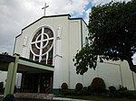
Ortigas Avenue

Ortigas Avenue is a 15.5 km (9.6 mi) highway running from eastern Metro Manila to western Rizal. It is one of the busiest highways in Metro Manila, serving as the main thoroughfare of the metro's east–west corridor, catering mainly to the traffic to and from Rizal. The western terminus of the highway is at the boundary of San Juan and Quezon City. The highway then traverses through Ortigas Center and along the cities of Mandaluyong, Quezon City, and Pasig, followed by the municipalities of Cainta and Taytay, and finally ending in the city of Antipolo. The portion of Ortigas Avenue from Eulogio Rodriguez Jr. Avenue (C-5) in Pasig to Taytay Diversion Road in Taytay is designated as a component of Radial Road 5 (R-5). The highway is also designated as National Route 60 (N60) and National Route 184 (N184) of the Philippine highway network, respectively.
Excerpt from the Wikipedia article Ortigas Avenue (License: CC BY-SA 3.0, Authors, Images).Ortigas Avenue
Ortigas Avenue, Mandaluyong
Geographical coordinates (GPS) Address Nearby Places Show on map
Geographical coordinates (GPS)
| Latitude | Longitude |
|---|---|
| N 14.595833333333 ° | E 121.05472222222 ° |
Address
Kilometer 11
Ortigas Avenue
1556 Mandaluyong
Philippines
Open on Google Maps


