place

The Lizard

Lizard PeninsulaNational nature reserves in CornwallNatural regions of EnglandNature Conservation Review sitesPeninsulas of Cornwall
Sites of Special Scientific Interest in CornwallSpecial Areas of Conservation in CornwallUse British English from October 2013
Lizard point cornwall

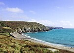
The Lizard (Cornish: An Lysardh) is a peninsula in southern Cornwall, England, United Kingdom. The most southerly point of the British mainland is near Lizard Point at SW 701115; Lizard village, also known as The Lizard, is the most southerly on the British mainland, and is in the civil parish of Landewednack, the most southerly parish. The valleys of the River Helford and Loe Pool form the northern boundary, with the rest of the peninsula surrounded by sea. The area measures about 14 by 14 miles (23 km × 23 km). The Lizard is one of England's natural regions and has been designated as a National Character Area 157 by Natural England. The peninsula is known for its geology and for its rare plants and lies within the Cornwall Area of Outstanding Natural Beauty (AONB).The Lizard's coast is particularly hazardous to shipping and the seaways round the peninsula were historically known as the "Graveyard of Ships" (see below). The Lizard Lighthouse was built at Lizard Point in 1752 and the RNLI operates The Lizard lifeboat station.

Excerpt from the Wikipedia article The Lizard (License: CC BY-SA 3.0, Authors, Images).

Geographical coordinates (GPS)

Latitude Longitude
N 50.033333333333 ° E -5.1833333333333 °
placeShow on map

Address

Grade-Ruan


, Grade-Ruan
England, United Kingdom
mapOpen on Google Maps

Lizard point cornwall
Share experience

Nearby Places

Grade–Ruan
Grade–Ruan

Grade–Ruan is a civil parish on the Lizard peninsula in Cornwall, England, United Kingdom, approximately ten miles (16 km) south of Falmouth.It is a rural parish bounded to the east by St Keverne parish and by the sea; to the west by Mullion and Cury parishes; and to the south by Landewednack parish. Grade–Ruan civil parish encompasses part of Goonhilly Downs and the major settlements are Ruan Minor, St Ruan and Cadgwith. The parish was formed in 1934 because falling population necessitated merging the ecclesiastical parishes of Grade, Ruan Major and Ruan Minor. All three were in the Deanery and Hundred of Kerrier. Formerly, Cadgwith was partly in Grade parish and partly in Ruan Minor parish. The population of Grade–Ruan has increased steadily; it was 677 in 1961, 835 in 1981, 1070 in 2001, and 936 in 2011. There is a school in the parish, Grade Ruan CE Primary School, which is situated in Ruan Minor. Grade–Ruan lies within the Cornwall Area of Outstanding Natural Beauty (AONB). The parish churches of the three former parishes are St Grada at Grade, and the churches of Ruan Major and Ruan Minor, the latter two dedicated to St Rumonus. All three have towers though Ruan Minor Church tower is very small. Ruan Major Church was greatly altered by Edmund Sedding in 1867 and is now a ruin. The church of Ruan Major lay within the manor of Winnianton; its benefice was united with that of Landewednack in 1754. (There was in medieval times a chapel at Hendra.) The church of St Rumon in Ruan Major is a grade I listed building.The church of Ruan Minor also lay within the manor of Winnianton; it was a separate rectory in 1277. The church is a small mainly 15th century building and has a Norman piscina.Erisey Manor House (originally in the parish of Grade) is a Grade II listed farmhouse. The oldest part is part of a house built in an E shape in 1620; this has been incorporated in an 18th-century rebuilding and extensions. The 1620 house was built by Richard Erisey; the Erisey male line came to an end in 1772. James Erisey was born at an earlier Erisey House; he sailed as a privateer with Sir Francis Drake.

Halliggye Fogou
Halliggye Fogou

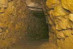
Halliggye Fogou is one of many fogous in Cornwall, England, United Kingdom. The site is under the guardianship of English Heritage, and managed by the Trelowarren Estate, where the fogou is located. Entry to the fogou is free but there is a charge to enter the rest of the Trelowarren Estate.The Halliggye Fogou consists of a long narrow tunnel leading to three sectioned chambers. A window-like entrance which was dug in Victorian times by supposed treasure hunters has since been filled in. The complex of passages has a roof and walls of stone, and is the largest and best-preserved of several mysterious tunnels associated with Cornish Iron Age settlements.It was described by Sir Richard Vyvyan in his "Account of the ‘fogou’ or cave at Halligey, Trelowarren", in the Journal of the Royal Institution of Cornwall (1885, viii. 256–58) In 1861, J. T. Blight wrote a comprehensive description and drafted plans of the fogou in conjunction with Sir Richard Vyvyan, the landowner who listed finds as a vase containing ashes and a roughly made cup, both of Celtic manufacture, and animal bones possibly from a deer.In the 1980s, a series of small excavations were carried out by English Heritage mainly to clear debris from the passage to aid examination and repair work after routine ploughing of the field, when the blade of the plough breached the roof of the main chamber: this hole has since been turned into an entrance stairway for visitors. Pottery found during excavations has included local Iron Age cordoned wares and some sherds of Roman Samian ware from southern Gaul.It was used during the Second World War by the Manaccan Auxiliary Unit as an explosives and ammunition store.