RAF Dry Tree
Military history of CornwallMilitary units and formations established in 1940Royal Air Force stations in CornwallUse British English from January 2018

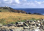
RAF Dry Tree was a Royal Air Force early warning radar station for detecting enemy aircraft during the Second World War. It was built in 1940 on Goonhilly Downs, on the Lizard peninsula in Cornwall, a short distance to the south-east of the Goonhilly Earth Station. It was named from the standing stone on the land known as the Dry Tree menhir.
Excerpt from the Wikipedia article RAF Dry Tree (License: CC BY-SA 3.0, Authors, Images).RAF Dry Tree
Bochym Hill,
Geographical coordinates (GPS) Address Nearby Places Show on map
Geographical coordinates (GPS)
| Latitude | Longitude |
|---|---|
| N 50.045583333333 ° | E -5.2050666666667 ° |
Address
RNAS Mullion
Bochym Hill
TR12 7AZ
England, United Kingdom
Open on Google Maps


