Brompton, London
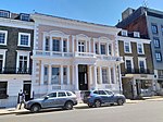
Brompton, sometimes called Old Brompton, survives in name as a ward in the Royal Borough of Kensington and Chelsea in London. Until the latter half of the 19th century it was a scattered village made up mostly of market gardens in the county of Middlesex. It lay south-east of the village of Kensington, abutting the parish of St Margaret's, Westminster at the hamlet of Knightsbridge to the north-east, with Little Chelsea to the south. It was bisected by the Fulham Turnpike, the main road westward out of London to the ancient parish of Fulham and on to Putney and Surrey. It saw its first parish church, Holy Trinity Brompton, only in 1829. Today the village has been comprehensively eclipsed by segmentation due principally to railway development culminating in London Underground lines, and its imposition of station names, including Knightsbridge, South Kensington and Gloucester Road as the names of stops during accelerated urbanisation, but lacking any cogent reference to local history and usage or distinctions from neighbouring settlements.Brompton has been home to many writers, actors and intellectuals. The Survey of London gives a long list. Its name survives formally to this day, only just, in the shared reference to two of the council's electoral wards called, "Brompton" and "Hans Town".
Excerpt from the Wikipedia article Brompton, London (License: CC BY-SA 3.0, Authors).Brompton, London
Lennox Gardens Mews, London Chelsea (Royal Borough of Kensington and Chelsea)
Geographical coordinates (GPS) Address Nearby Places Show on map
Geographical coordinates (GPS)
| Latitude | Longitude |
|---|---|
| N 51.495 ° | E -0.164 ° |
Address
Lennox Gardens Mews 10
SW3 2QE London, Chelsea (Royal Borough of Kensington and Chelsea)
England, United Kingdom
Open on Google Maps


