place

Cranford, London

Areas of LondonDistricts of the London Borough of HounslowPlaces formerly in MiddlesexUse British English from August 2015Wards of the London Borough of Hounslow
Hither Moor Road, Stanwell Moor geograph.org.uk 131647

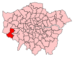
Cranford is a suburban area straddling the London Boroughs of Hillingdon and Hounslow. It is located 12.5 miles (20 km) west of Charing Cross and immediately east of Heathrow Airport, from which it is separated by the River Crane. A village till the mid-20th century, Cranford was developed with the building of major roads in its area.

Excerpt from the Wikipedia article Cranford, London (License: CC BY-SA 3.0, Authors, Images).

Cranford, London
Burnham Gardens, London Cranford (London Borough of Hounslow)

Geographical coordinates (GPS) Address Nearby Places
placeShow on map

Wikipedia: Cranford, LondonContinue reading on Wikipedia

Geographical coordinates (GPS)

Latitude Longitude
N 51.4766 ° E -0.4079 °
placeShow on map

Address

Burnham Gardens

Burnham Gardens
TW4 6LR London, Cranford (London Borough of Hounslow)
England, United Kingdom
mapOpen on Google Maps

Hither Moor Road, Stanwell Moor geograph.org.uk 131647
Share experience

Nearby Places

Hatton, London
Hatton, London

Hatton including Hatton Cross is a small settlement and locality in the London boroughs of Hillingdon and Hounslow, on the south-eastern edge of London Heathrow Airport and straddling the A30 road. Prior to 1965 it was in the county of Middlesex. The area was for many decades a notorious place for highway robberies and its surviving old inn, The Green Man has a hiding-hole behind the chimney. A nearby road is named Dick Turpin Way accordingly. Aside from the heyday of such problems in the 17th and 18th century the area had attractive rural houses with gardens, one having been built by Edward III and visited by Richard II, another centuries later having been the home of Sir Frederick Pollock, 1st Baronet through to his grandson, first cousin of the first Viscount Hanworth resident at much larger Hanworth Park. It remains technically a hamlet or neighbourhood of Bedfont from which it is separated by a field and local sports facilities. It is flanked to the north and north-west by major roads, depots, warehouses, hotels and parking areas associated with London Heathrow Airport which take up the north of the locality, leading to the consolidation of that area into Hillingdon since 1994. It is joined, south, by Bedfont and North Feltham and to the east by the River Crane, over which is Hounslow West. The settled part is the interior and one side of a triangle south of the dualled A30. Further south a line of houses continues which faces Hounslow Urban Farm and is then engulfed by naming into the North Feltham Trading Estate such as Feltham Ambulance Station beside the farm. The current naming has eaten into what was once squarely Hatton, just as Heathrow has from the opposite direction.