Purdown
Bristol geography stubsHills of Bristol

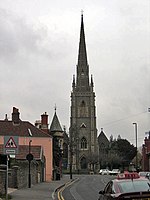
Purdown (sometimes spelt Pur Down) is a hill in the north east of Bristol, England. The suburb of Lockleaze lies on its western flanks, and the Stoke Park estate occupies its eastern flanks. The M32 motorway crosses the eastern side of the hill. The Purdown BT Tower is constructed near the highest point of the hill.
Excerpt from the Wikipedia article Purdown (License: CC BY-SA 3.0, Authors, Images).Purdown
Wright Way,
Geographical coordinates (GPS) Address Nearby Places Show on map
Geographical coordinates (GPS)
| Latitude | Longitude |
|---|---|
| N 51.487 ° | E -2.56 ° |
Address
Stoke Park Estate (Stoke Park)
Wright Way
BS16 1WS , Stoke Park
England, United Kingdom
Open on Google Maps


