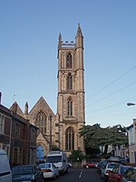
South Purdown, Bristol

South Purdown, Bristol, is an ancient green space located in north Bristol, England. The area of land is bordered by central Muller Road, Sir Johns Lane Allotment site, Stoke Park, Lockleaze Open Space and the Priory Hospital, and has been designated a Site of Nature Conservation Interest and an important wildlife corridor.Known for its natural unmodified meadows alongside outstanding views across the west of Bristol City, the area is traversed by a number of public footpaths, used heavily by local running groups and dog walkers, and is regularly used for local wildlife events, including Bat Walks due to its strong and abundant hedgerows. Numerous neighbourhood events take place at South Purdown, involving local community groups, individuals and schools.
Excerpt from the Wikipedia article South Purdown, Bristol (License: CC BY-SA 3.0, Authors, Images).South Purdown, Bristol
Sir Johns Lane, Bristol Eastville
Geographical coordinates (GPS) Address Nearby Places Show on map
Geographical coordinates (GPS)
| Latitude | Longitude |
|---|---|
| N 51.479 ° | E -2.569 ° |
Address
Sir Johns Lane
BS5 6UB Bristol, Eastville
England, United Kingdom
Open on Google Maps


