Stapleton, Bristol

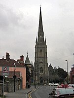
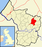
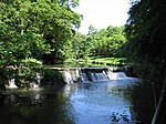
Stapleton is an area in the northeastern suburbs of the city of Bristol, England. The name is colloquially used today to describe the ribbon village along Bell Hill and Park Road in the Frome Valley. It borders Eastville to the South and Begbrook and Frenchay to the North. It comprises an eclectic mix of housing mainly from the Victorian, Edwardian, inter-war and late 20th century periods. It is a popular residential area on three counts. It is convenient for the M32 motorway (with rapid access the M4 and M5), it is a semi rural area within two miles of central Bristol and it boasts a popular public school. Stapleton's church is a prominent Bristol landmark, visible from the M32 motorway as motorists pass by.
Excerpt from the Wikipedia article Stapleton, Bristol (License: CC BY-SA 3.0, Authors, Images).Stapleton, Bristol
Bell Hill, Bristol Stapleton
Geographical coordinates (GPS) Address Website Nearby Places Show on map
Geographical coordinates (GPS)
| Latitude | Longitude |
|---|---|
| N 51.4804 ° | E -2.5552 ° |
Address
Collegiate School
Bell Hill
BS16 1BJ Bristol, Stapleton
England, United Kingdom
Open on Google Maps


