place

Holland River

Golden Horseshoe geography stubsOntario river stubsRivers of Simcoe CountyRivers of the Regional Municipality of YorkTributaries of Lake Simcoe
Aerial Cooks Bay, Lake Simcoe, Ontario from SW 01 white balanced (9659705784)

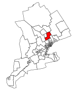
The Holland River is a river in Ontario, Canada, that drains the Holland River watershed into Cook's Bay, the southern extremity of Lake Simcoe. The river flows generally north, and its headwaters lie in the Oak Ridges Moraine. The Holland River watershed is approximately 600 square kilometres (230 sq mi), spanning an area that includes New Tecumseth, King Township, Newmarket, Aurora, East Gwillimbury, and Whitchurch-Stouffville. The river's watershed also contains the Holland Marsh, a fertile farmland region renowned for its vegetable production. The river was originally known as Micicaquean Creek, its indigenous name. It was renamed by Lieutenant-Governor Simcoe after Captain Samuel (Johannes) Holland, (1729–1801), Dutch-born first Surveyor General of British North America.The Lake Simcoe Region Conservation Authority is responsible for leading the protection and environmental health of the Holland River, as it is within the Lake Simcoe watershed area.

Excerpt from the Wikipedia article Holland River (License: CC BY-SA 3.0, Authors, Images).

Holland River
13th Line, Bradford West Gwillimbury

Geographical coordinates (GPS) Address Nearby Places
placeShow on map

Wikipedia: Holland RiverContinue reading on Wikipedia

Geographical coordinates (GPS)

Latitude Longitude
N 44.202777777778 ° E -79.515277777778 °
placeShow on map

Address

13th Line

13th Line
L0L 1R0 Bradford West Gwillimbury
Ontario, Canada
mapOpen on Google Maps

Aerial Cooks Bay, Lake Simcoe, Ontario from SW 01 white balanced (9659705784)
Share experience

Nearby Places

Innisfil GO Station

Innisfil GO Station is a planned GO Transit train station to be built by Metrolinx on the Barrie line in Innisfil, Ontario as part of its GO Expansion program. A parking lot, a bus loop and a park and ride area will be provided. In 2016, Metrolinx rated the station location highly for affordability of construction but low for ridership, which is expected to be 2,800 per day in 2031. In 2020, the cost to build the station was estimated to be CA$29 million. The town of Innisfil wanted construction to begin in 2022 and the station open by September 2022. However, in May 2022 construction of the station was delayed to 2023.A station in Innisfil had first been proposed in a 2010 GO Transit system electrification study. In 2015, Metrolinx proposed it again as part of a larger list of potential future station sites, and it was ultimately included in the list of stations to be built within the RER program. In 2016, there were 2 potential sites for a station in Innisfil: 5th Line and 6th Line. The location of the station had been controversial among residents and developers in the area. Innisfil Town Council supported the 6th line location and it was ultimately chosen by Metrolinx.In November 2019, Cortel Group committed to funding the full cost of the station and the Innisfil Town Council approved 'The Oribit', a long-term development vision around the station with the goal of 30,000 people living in the area in the near future. Initially, the long-term goal after the development's completion was for 150,000 residents, though this has since been reduced to 90,000 residents and 20,000 jobs. In 2020, a minister's zoning order (MZO) was issued by the provincial government to expedite the residential development project.