place

Holland Marsh

Landforms of Simcoe CountyLandforms of the Regional Municipality of YorkMarshes of OntarioPolders
Harvesting carrots on the Holland Marsh

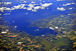
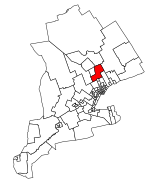
The Holland Marsh is a wetland and agricultural area in Ontario, Canada, about 50 kilometres (31 mi) north of Toronto. It lies entirely within the valley of the Holland River, stretching from the northern edge of the Oak Ridges Moraine near Schomberg to the river mouth at Cook's Bay, Lake Simcoe. In its entirety it comprises about 21,000 acres (8,500 hectares), with two distinct divisions. Historically it has simply been referred to as "the marsh". The first area to be drained and reclaimed for farming is a 7,200-acre (2,915-hectare) municipally drained polder south-west of the town of Bradford proper, of which 40% lies in King Township (York Region) and 60% in the town of Bradford West Gwillimbury (Simcoe County). The other 13,800 acres (5,585 hectares) lie north and east of Bradford, fringing Cook's Bay in the towns of Innisfil and East Gwillimbury. Portions of this area have been privately reclaimed for farming, such as the Ravenshoe Road and Bradford Marsh areas, and portions are recreational or undisturbed wetland. In some cases, recreational boating, wetland and agricultural areas intersect.

Excerpt from the Wikipedia article Holland Marsh (License: CC BY-SA 3.0, Authors, Images).

Holland Marsh
Boag Road, East Gwillimbury

Geographical coordinates (GPS) Address Nearby Places
placeShow on map

Wikipedia: Holland MarshContinue reading on Wikipedia

Geographical coordinates (GPS)

Latitude Longitude
N 44.165 ° E -79.515555555556 °
placeShow on map

Address

Boag Road

Boag Road
L9N 1J4 East Gwillimbury
Ontario, Canada
mapOpen on Google Maps

Harvesting carrots on the Holland Marsh
Share experience

Nearby Places

East Holland River

The East Holland River is a river in Ontario, Canada that is part of the Holland River watershed that empties into Cook's Bay in Lake Simcoe. The headwaters of the East Holland River rise in the Oak Ridges Moraine. The river runs generally north from the town of Newmarket, and through Holland Landing where it joins up with the West Holland River. A map of the Holland River watershed published by the Lake Simcoe Region Conservation Authority shows tributaries to the East Holland River include Sharon Creek, Bogart Creek, Tannery Creek (from Aurora, Ontario), Western Creek (from the west side of Newmarket), and Weslie Creek. A dam on the East Holland River in Newmarket maintains a man-made lake called Fairy Lake, originally a millpond, but now used for recreation. There has been a dam at this site since 1801. The current dam was damaged, albeit not severely, by Hurricane Hazel in 1954. Musselman Lake in Whitchurch-Stouffville feeds a creek that runs along Vandorf Sideroad and into Weslie Creek. Despite concerns of a lack of water, construction of several locks was started along the river between Newmarket and Holland Landing as part of a 'Holland River Canal' that would have joined Newmarket to the Trent-Severn Waterway. There is one lock in each of those places along with another at Rogers Reservoir in East Gwillimbury. Rogers Reservoir and Fairy Lake in Newmarket were to act as reservoirs for the canal waters. There were two swing bridges built in East Gwillimbury; one on Green Lane and the other on Main Street North (Concession 2). Both have been replaced by permanent structures. On Green Lane the road now runs slightly to the south and a pedestrian bridge crosses the old structure. There is also a quayside at Davis Drive in Newmarket. The canal works were abandoned early in the 20th century without ever being completed. The upper limit of navigation on the East Holland River remains at River Drive Park, about 2 km downstream from Holland Landing.