place

Ames Center

2009 establishments in MinnesotaBuildings and structures in Dakota County, MinnesotaBurnsville, MinnesotaPerforming arts centers in MinnesotaTourist attractions in Dakota County, Minnesota
Ames Center Burnsville Minnesota

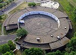
The Ames Center, formerly the Burnsville Performing Arts Center, is a performing arts venue in Burnsville, Minnesota, adjacent to Nicollet Commons Park, which features green space, water fountains, and a 250-seat outdoor performance amphitheater. The Ames Center features an eclectic range of performances on the main stage and the black box theatres including: dance, theatre, concerts, comedians, and written word. Past performances include the Girl Singers of the Hit Parade, Larry Carlton, Louie Anderson, Lori Lane, Richard Marx, Church Basement Ladies, Melissa Manchester, Bill Engvall, Nick Colionne, Celtic Crossroads, Twin Cities Ballet of Minnesota, Elizabeth Gilbert, Rob Lake, Tommy Emmanuel, Sinbad, Ralphie May, Dakota Valley Symphony, Chameleon Theater Circle, Miss Minnesota USA/Teen USA, and Cirque D’Or. Additionally, productions of Mame, A Christmas Carol and Peter Pan were presented utilizing sets created for the Kennedy Center, the Kodak Theatre and the original Cathy Rigby Broadway production respectively.

Excerpt from the Wikipedia article Ames Center (License: CC BY-SA 3.0, Authors, Images).

Geographical coordinates (GPS)

Latitude Longitude
N 44.7741 ° E -93.2795 °
placeShow on map

Address

Ames Center

Nicollet Avenue South 12600
55337
Minnesota, United States
mapOpen on Google Maps

Phone number

call+19528954685

Website
ames-center.com

linkVisit website

linkWikiData (Q5000177)
linkOpenStreetMap (208359489)

Ames Center Burnsville Minnesota
Share experience

Nearby Places

Burnsville Heart of the City station

Burnsville Heart of the City is a bus rapid transit station along the Metro Orange Line and its southern terminal. The station is located at the corner of Minnesota State Highway 13 in the downtown of Burnsville, Minnesota. The station is located between Minnesota Valley Transit Authority's (MVTA) Burnsville Transit Station and Heart of the City Park and Ride, providing bus connections and park and ride capacity. Original plans considered the Orange Line's southern terminus at MVTA's Burnsville Transit Station, but Burnsville City Council supported a new station in their downtown district, Heart of the City, kitty-corner from the MVTA facility. During the planning of the Orange Line, the station was known as Travelers Trail and later Nicollet Avenue. In 2017, Burnsville City Council recommended Burnsville Heart of the City to provide a geographical reference to their downtown, as well as strengthening local identity. The station opened December 4, 2021 along with the rest of the Orange Line. Burnsville city officials hosted an opening day celebration at Nicollet Commons Park, one block south of the station. The Heart of the City municipal parking ramp will serve as a park-and-ride location for the station.The Heart of the City area is a New Urbanism area with some transit-oriented development and land use patterns that feature higher density, more walkable infrastructure, and mixed-use buildings. It serves as Burnsville's downtown and has been under development since 1990s. The development patterns of the district helped encourage Metro Transit to locate the station where it is. Several Heart of the City apartment buildings have advertised the station and Orange Line in marketing materials and developers cited the station's proximity as being attractive.

Burnsville, Minnesota

Burnsville ( BURNZ-vil) is a city 15 miles (24 km) south of downtown Minneapolis in Dakota County, Minnesota. The city is situated on a bluff overlooking the south bank of the Minnesota River, upstream from its confluence with the Mississippi River. Burnsville and nearby suburbs form the southern portion of Minneapolis–Saint Paul, the 16th-largest metropolitan area in the United States, with about 3.7 million residents. At the 2020 census the population was 64,317.Burnsville is home to a regional mall (Burnsville Center), a section of Murphy-Hanrehan Park Reserve, 310-foot (94 m) vertical ski peak Buck Hill, and part of the Minnesota Valley National Wildlife Refuge. Burnsville stands on land that once contained a village of Mdewakanton Dakota. Later, it became a rural Irish farming community. Burnsville became Minnesota's 14th-largest city in the 2020 census following the construction of Interstate 35. Now the ninth-largest suburb in the metro area and a bedroom community of both Minneapolis and Saint Paul, it was fully built by the late 2000s. Burnsville's downtown area is called Heart of the City with urban-style retail and condominiums. The Burnsville Transit Station serves as the hub and headquarters of the Minnesota Valley Transit Authority, providing regional bus service to five other suburbs. The name Burnsville is attributed to an early Irish settler and land owner, William Byrne. His surname was recorded as "Burns" and was never corrected.

Freeway Sanitary Landfill

The Freeway Sanitary Landfill is a United States Environmental Protection Agency Superfund site that covers 140 acres (57 ha) in Burnsville, Minnesota. In 1971 the Minnesota Pollution Control Agency (MCPA) licensed the landfill to accept 1,920 acre-feet (2,370,000 m3) of household, commercial, demolition, and nonhazardous industrial wastes. The state permit prohibited the disposal of liquids and hazardous wastes; however, heavy metals, acids, and bases were accepted by the landfill from local industries. The landfill also accepted 200 cubic yards (150 m3) of battery casings and 448 short tons (406,000 kg) of aluminum sweat furnace slag. Overall, the landfill contains nearly 5,000,000 cubic yards (3,800,000 m3) of waste. The waste is covered by a low permeability soil cover. Groundwater contains contaminants which exceed drinking water standards, including volatile organic compounds (VOCs) such as tetrachloroethylene and vinyl chloride, and manganese and thallium. City of Burnsville municipal wells are located about 4,000 feet (1,200 m) to the south of the landfill. These wells serve approximately 36,000 people. Currently the groundwater beneath the Freeway Landfill flows south into the Kraemer Quarry due to long term dewatering of the quarry for mining purposes. When this pumping ceases the ground water flow will be reversed and the contaminated ground water will flow into the Minnesota River approximately 400 feet (120 m) from the landfill.