Golborne Road
Notting HillStreets in the Royal Borough of Kensington and ChelseaUse British English from June 2015

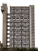
Golborne Road is a street in the Royal Borough of Kensington and Chelsea in London's Kensal Town. The road runs east from Portobello Road to Kensal Road. Golborne Road is situated just north of and parallel to the Westway; it also joins Portobello Road. The nearest Underground stations are Westbourne Park and Ladbroke Grove. It is a major street within the Golborne electoral ward of the local authority, Kensington and Chelsea Borough Council, which also includes the nearby Trellick Tower (pictured) and Grand Union Canal.
Excerpt from the Wikipedia article Golborne Road (License: CC BY-SA 3.0, Authors, Images).Golborne Road
Golborne Road, London North Kensington (Royal Borough of Kensington and Chelsea)
Geographical coordinates (GPS) Address Nearby Places Show on map
Geographical coordinates (GPS)
| Latitude | Longitude |
|---|---|
| N 51.52162 ° | E -0.20881 ° |
Address
Golborne Road 91
W10 5NP London, North Kensington (Royal Borough of Kensington and Chelsea)
England, United Kingdom
Open on Google Maps


