place

Llandecwyn

Pages including recorded pronunciationsTalsarnauVillages in GwyneddVillages in Snowdonia
Llandecwyn Church geograph.org.uk 694707

Llandecwyn () is a hamlet near Penrhyndeudraeth in Gwynedd, Wales. The bulk of the population (between 40 and 50 houses) is now located around Cilfor close to the A496 road and served by Llandecwyn railway station, with a cluster of under ten houses around the road junction at Capel Brontecwyn half a mile up the hill to the southeast, and other isolated houses and farms scattered across the hillsides. Formerly, there was a sizeable population closer to the Anglican church of Saint Tecwyn and the lakes: Llyn Tecwyn Isaf and Llyn Tecwyn Uchaf. The church now stands alone, three-quarters of a mile due east of Cilfor. There is a children's play area at Cilfor, but there are no shops or schools. The former parish of Llandecwyn stretched from the estuary of the Afon Dwyryd at Pont Briwet to the hills of the Rhinogs. It included the Bryn Bwbach road from Capel Brontecwyn to Eisingrug, a section of the main A496 road between Llandecwyn and Talsarnau, and a section of the main A496 road between Llandecwyn and Maentwrog. It also included land across the River Dwyryd: the area of Cefn Coch and around Rhiw Goch and the road to Llanfrothen. Most of the former parish is now part of the Bro Ardudwy ministry area, which includes Harlech, a few kilometres to the southwest, and Barmouth. Pen Llandecwyn, the small hill between Saint Tecwyn's church and Llyn Tecwyn Uchaf, is 203 m (666 ft) high.

Excerpt from the Wikipedia article Llandecwyn (License: CC BY-SA 3.0, Authors, Images).

Llandecwyn
Fronlief Hir,

Geographical coordinates (GPS) Address Nearby Places
placeShow on map

Wikipedia: LlandecwynContinue reading on Wikipedia

Geographical coordinates (GPS)

Latitude Longitude
N 52.918 ° E -4.035 °
placeShow on map

Address

Fronlief Hir

Fronlief Hir
LL47 6YT
Wales, United Kingdom
mapOpen on Google Maps

Llandecwyn Church geograph.org.uk 694707
Share experience

Nearby Places

Rhiw Goch
Rhiw Goch

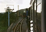
Rhiw Goch is a passing point on the Ffestiniog Railway north of the village of Penrhyndeudraeth in Wales. It was originally a passing loop and an exchange point for the horses that worked the line, opening in 1836. Horses were stabled overnight at Rhiw Goch farm, which adjoins the line further south nearer to the village. When the railway converted to using steam locomotives in 1863, Rhiw Goch passing loop was no longer needed and was closed. The passing loop was reinstated at Rhiw Goch in 1975. Its location, approximately equidistant from Minffordd and Tan-y-Bwlch stations, allows maximum flexibility in timetabling, permitting up and down trains to cross with minimum waiting. The location provides a long passing loop which accommodates full length Ffestiniog trains. This is the only former 'horse station' at which it is still possible to pass trains, although Cae Ednyfed, lies within the current Minfford station limits. In 1989 the box was taken out of use, with the signal heads being removed and the token instrument from Tan-y-Bwlch, and the although trap points (from Minffordd) were installed at the Tan-y-Bwlch end of the loop, they were never commissioned. During this period, the ground frame was only usable as a refuge siding, and it was not possible to cross passenger trains. In 1999 the box was recommissioned, with replacement signal heads being installed, the Tan-y-Bwlch end trap points were removed and new power cabling was installed. Rhiw Goch has the only regularly staffed signal box on the railway and the 1974 vintage box was replaced by a new enlarged box during 2006/7. This included provision for the bats which have made the signal box their home. Although trains regularly stop here to wait for a train travelling in the opposite direction to pass, passengers can not alight from or join trains here. There is no public access to Rhiw Goch except by train.