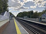
Burgess Hill

Burgess Hill ( (listen)) is a town and civil parish in West Sussex, England, close to the border with East Sussex, on the edge of the South Downs National Park, 39 mi (63 km) south of London, 10 mi (16 km) north of Brighton and Hove, and 29 mi (47 km) northeast of the county town, Chichester. It had an area of 3.7 sq mi (9.6 km2) and a population of 30,635 at the 2011 Census, making it the fourth most populous parish in the county (behind Crawley, Worthing and Horsham) and the most populous in the Mid Sussex District. Other nearby towns include Haywards Heath to the northeast and Lewes, the county town of East Sussex, to the southeast. Burgess Hill is just on the West Sussex side of the border dividing the two counties, although parts of the World's End district are across the county boundary in the Lewes district of East Sussex.Burgess Hill is twinned with Schmallenberg in Germany and Abbeville in France.
Excerpt from the Wikipedia article Burgess Hill (License: CC BY-SA 3.0, Authors, Images).Burgess Hill
Keymer Road, Mid Sussex World's End
Geographical coordinates (GPS) Address Nearby Places Show on map
Geographical coordinates (GPS)
| Latitude | Longitude |
|---|---|
| N 50.9535 ° | E -0.1262 ° |
Address
The Top House
Keymer Road 5
RH15 0AD Mid Sussex, World's End
England, United Kingdom
Open on Google Maps


