Little Canfield
Civil parishes in EssexEssex geography stubsUse British English from June 2015UttlesfordVillages in Essex
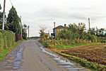
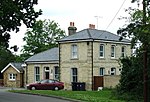
Little Canfield is a village and a civil parish in the Uttlesford district of Essex, England. The village is situated the B1256 road, near the A120 road and the villages of Smiths Green and Takeley. As of 2021, its population is approximately 1,350. Little Canfield is in the Takeley and the Canfields ward of Uttlesford, and the Dunmow division of Essex County Council. The village is currently expanding as housing developments are being built around the area. It has a public house, the Lion and Lamb.
Excerpt from the Wikipedia article Little Canfield (License: CC BY-SA 3.0, Authors).Little Canfield
Uttlesford Great Canfield
Geographical coordinates (GPS) Address Nearby Places Show on map
Geographical coordinates (GPS)
| Latitude | Longitude |
|---|---|
| N 51.85 ° | E 0.3 ° |
Address
Cow Common
CM6 1LB Uttlesford, Great Canfield
England, United Kingdom
Open on Google Maps


