Moel Ysgyfarnogod
Hewitts of WalesMarilyns of WalesMountains and hills of GwyneddMountains and hills of SnowdoniaNuttalls ... and 3 more
Pages with Welsh IPATalsarnauTrawsfynydd

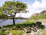
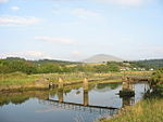
Moel Ysgyfarnogod (Welsh for 'Bare hill of the hares') is a mountain in Snowdonia, North Wales and is the northernmost of the Rhinogydd. Rhinog Fawr lies directly south.It overlooks Llyn Trawsfynydd, and from the summit it is possible to see the towns of Porthmadog and Blaenau Ffestiniog. It may be climbed from Trawsfynydd in the east, or from Talsarnau in the west. To the north-west of the summit, on an area of moorland and rocky outcrops, lies Bryn Cader Faner, an ancient stone circle. It is one of the finest examples of a Bronze Age cairn in Britain, and has rocky standing stones along its circumference.
Excerpt from the Wikipedia article Moel Ysgyfarnogod (License: CC BY-SA 3.0, Authors, Images).Moel Ysgyfarnogod
Mine Track,
Geographical coordinates (GPS) Address Nearby Places Show on map
Geographical coordinates (GPS)
| Latitude | Longitude |
|---|---|
| N 52.89115 ° | E -3.9961694444444 ° |
Address
Mine Track
LL47 6YU
Wales, United Kingdom
Open on Google Maps


