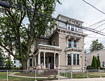
Reservoir, Providence, Rhode Island
Neighborhoods in Providence, Rhode IslandProvidence, Rhode Island stubsRhode Island geography stubs

Reservoir is a neighborhood in southwest Providence, Rhode Island. It is bounded to the north and east by the Amtrak Northeast Corridor railroad tracks, and to the west and south by the municipal boundary with Cranston. The population of the neighborhood, as of 2000, was 2,963. Mashapaug Pond lies entirely within the Reservoir neighborhood. The Gorham Manufacturing Company made its home on the pond in the area.The neighborhood is 40.5% Non-Hispanic White, 15.4% Asian or Pacific Islander, 16.6% African-American, and 22.6% Hispanic. The median household income is $39,769, and the median family income is $41,202. 10.4% of families live below the poverty line.
Excerpt from the Wikipedia article Reservoir, Providence, Rhode Island (License: CC BY-SA 3.0, Authors, Images).Reservoir, Providence, Rhode Island
Access Road, Providence
Geographical coordinates (GPS) Address Nearby Places Show on map
Geographical coordinates (GPS)
| Latitude | Longitude |
|---|---|
| N 41.794 ° | E -71.436 ° |
Address
Access Road
Access Road
02910 Providence
Rhode Island, United States
Open on Google Maps


