South Side, Providence, Rhode Island

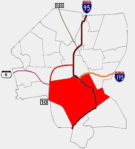
The South Side of Providence, Rhode Island, originally South Providence, is a term frequently used to describe the collective region comprising the official neighborhoods of Upper and Lower South Providence, Elmwood and the West End. The name was first used in the 1830s when the New York, Providence and Boston Railroad established its first station at a pier on the Providence River on a point of land about one half mile south of downtown Providence. The station was named South Providence.Hispanics comprise the majority of the population, with over half its residents claiming Hispanic ancestry, as compared to thirty percent of Providence residents as a whole. Consequently, it has a high percentage (64%) of children enrolled in public school whose first language is not English, with the most commonly spoken language being Spanish.The area continues to struggle with poverty issues; the South Side's median family income is $23,379 as compared with $32,058 for the city as a whole, and more than one out of three families lives in poverty.
Excerpt from the Wikipedia article South Side, Providence, Rhode Island (License: CC BY-SA 3.0, Authors, Images).South Side, Providence, Rhode Island
Daboll Street, Providence
Geographical coordinates (GPS) Address Nearby Places Show on map
Geographical coordinates (GPS)
| Latitude | Longitude |
|---|---|
| N 41.804 ° | E -71.424 ° |
Address
Daboll Street 114
02907 Providence
Rhode Island, United States
Open on Google Maps


