place

Andover Center Historic District

British colonial architecture in the United StatesFederal architecture in ConnecticutHistoric districts in Tolland County, ConnecticutHistoric districts on the National Register of Historic Places in ConnecticutNRHP infobox with nocat
National Register of Historic Places in Tolland County, ConnecticutUse mdy dates from August 2023
Andover Historical Society, Andover, Connecticut

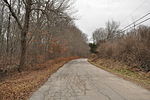
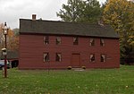
The Andover Center Historic District encompasses the historic town center of Andover, Connecticut. Centered on the junction of Hebron Road with Center Street and Cider Mill Road, the district includes houses dating to the town's early history, civic buildings including a library and former town hall, and the town's first cemetery. The district was listed on the National Register of Historic Places in 2003.

Excerpt from the Wikipedia article Andover Center Historic District (License: CC BY-SA 3.0, Authors, Images).

Andover Center Historic District
Hebron Road,

Geographical coordinates (GPS) Address Nearby Places
placeShow on map

Wikipedia: Andover Center Historic DistrictContinue reading on Wikipedia

Geographical coordinates (GPS)

Latitude Longitude
N 41.734166666667 ° E -72.375 °
placeShow on map

Address

Hebron Road 58
06232
Connecticut, United States
mapOpen on Google Maps

Andover Historical Society, Andover, Connecticut
Share experience

Nearby Places

Wangumbaug Lake
Wangumbaug Lake

Wangumbaug Lake, also known as Coventry Lake, is a natural lake located in Coventry, Connecticut. It covers 378 acres (1.53 km2) and is about 35 feet (11 m) deep and 1.8 miles (2.9 km) long with a circumference of 5 miles (8.0 km). Its watershed is 1,992 acres (8.06 km2), around 40% of which is residential and the rest farms and forest. The lake holds 2.7 billion gallons (10,220,000 m³) of water. It is fed by springs and has one natural outlet, Coventry Lake Brook, which flows southeast into the Willimantic River. Melt from a retreating glacier formed the lake 13,000 years ago.Wangumbaug means "Crooked Pond" in Algonquian. It was likely named by the Nipmuc, who settled the area before European contact.The lake has been a popular summer vacation destination for boaters and bathers. Artists flocked to the summer cottages along the shores. In the early twentieth century, a trolley line connected the towns of Coventry and Willimantic, and Wangumbaug Lake became known as "Willimantic's summer resort." A pavilion known as the Lakeside Casino was a popular dance hall. Wangumbaug Lake is currently the home of the UConn Huskies rowing team, which shares its boathouse with the Edwin O. Smith High School crew team from nearby Mansfield. A two-acre lake island, Underwood Island, is located 100 yards from Wangumbaug's shoreline. The village and census-designated place of Coventry Lake includes the lake and surrounding residential areas. The regional climate is hemiboreal.