place

March Route of Rochambeau's Army: Hutchinson Road

American Revolution on the National Register of Historic PlacesAndover, ConnecticutConnecticut in the American RevolutionHistoric districts in Tolland County, ConnecticutHistoric places on the Washington–Rochambeau Revolutionary Route
NRHP infobox with nocatNational Register of Historic Places in Tolland County, ConnecticutRoads on the National Register of Historic Places in Connecticut
CoventryCT HutchinsonRoad

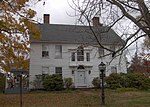
The March Route of Rochambeau's Army: Hutchinson Road is a 2-acre (0.81 ha) historic road section in Andover, Connecticut. The section of Hutchinson Road, laid out in the early 18th century and formerly an alignment of United States Route 6, formed part of the 1781-82 march routes of Rochambeau's army which contributed to American victory in the American Revolutionary War. It was listed on the National Register of Historic Places in 2002.

Excerpt from the Wikipedia article March Route of Rochambeau's Army: Hutchinson Road (License: CC BY-SA 3.0, Authors, Images).

March Route of Rochambeau's Army: Hutchinson Road
Hendee Road,

Geographical coordinates (GPS) Address Nearby Places
placeShow on map

Wikipedia: March Route of Rochambeau's Army: Hutchinson RoadContinue reading on Wikipedia

Geographical coordinates (GPS)

Latitude Longitude
N 41.757277777778 ° E -72.399694444444 °
placeShow on map

Address

Hendee Road 15
06232
Connecticut, United States
mapOpen on Google Maps

CoventryCT HutchinsonRoad
Share experience

Nearby Places

Fifth Camp of Rochambeau's Infantry

The Fifth Camp of Rochambeau's Infantry, also known as Site 12-25, is a historic site and an archeological site in Bolton, Connecticut, on the march route of Rochambeau's army on its way to the Hudson River and ultimately to Yorktown, Virginia. It was used on four successive nights, the 22nd through the 25th of June, 1781, by the four divisions of Rochambeau's army (the Bourbonnais, the Royal Deux-Ponts, the Soissonnais, and the Saintonge).: E3  In the evenings, the French entertained locals by playing music and dancing with local women, on Bolton Green.: E5 About 1 mile (1.6 km) before the Fifth Camp is March Route of Rochambeau's Army: Bailey Road, and about a mile before that is March Route of Rochambeau's Army: Hutchinson Road, both on the way from Andover, and both also NRHP-listed. The road to the Fifth Camp was described as "frightful". The Bourbonnais division had to bivouac without its tents, as its supply wagons were delayed on the poor roads.: E4 It is a 13-acre (5.3 ha) site that was listed on the National Register of Historic Places in 2001.The site is listed for its information potential. According to a study completed in 2001, the site "is an open field that retains its visual qualities, with stone walls marking the same field lines as shown on the map prepared by the French engineers. The camp was occupied for four nights in a row, one night by each regiment, in June, 1781. A large number of artifacts have been recovered to date, including numbered regimental buttons, .66 caliber musket balls, period coins, and a lead bar."The camp site was not used on the return march in 1782; the 46th camp site was at a different location in what is now Andover which was then part of Bolton.: E3 

Bolton Green Historic District

Bolton Green Historic District is a historic district that includes the town green, Bolton Green, of the town of Bolton, Connecticut. The green and the surrounding buildings were listed on the National Register of Historic Places in 2001. The district encompasses 9 buildings, 1 site, 4 structures, and 2 objects that contribute to the historical significance of the area. The district extends east about 500 yards (460 m) from the green along Bolton Center Road. The oldest existing buildings around the Green are the former tavern and the Bolton General Store. The most prominent building around the Green is the Bolton Congregational Church, a Greek Revival structure built in 1818 with a truncated box-spire. Other structures around the green are a house facing the green on the east side built in the 1840s, and a new ranch house that was built on the former site of an 1870s house that was destroyed by fire. Other properties in the district includes the Brick Tavern, the site of Bolton's first post office, the town hall, the Tuthill residence, and the Bolton Heritage Farm. The green itself is triangular in shape and is located at the junction of Bolton Center Road and Hebron Road. The Green is an open, well-kept grassy area defined by the roads and trees. The green contains two war memorials commemorating World War I and World War II; and Korea and Vietnam combined, flanking a flagpole. Bolton Green continues to be used as an open space maintained for public use and town commemorative functions.The Washington-Rochambeau Revolutionary Route National Historic Trail passes through the Bolton Green historic district.