Huncote
BlabyCivil parishes in LeicestershireLeicestershire geography stubsUse British English from April 2014Villages in Leicestershire

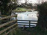
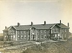
Huncote is a village and civil parish in the district of Blaby in the county of Leicestershire, England. It is just west of Narborough, and is on the Thurlaston Brook. The place-name Huncote is the etymological root of the American surnames Hunnicutt, and Honeycut.
Excerpt from the Wikipedia article Huncote (License: CC BY-SA 3.0, Authors, Images).Huncote
Main Street,
Geographical coordinates (GPS) Address Nearby Places Show on map
Geographical coordinates (GPS)
| Latitude | Longitude |
|---|---|
| N 52.572 ° | E -1.2388 ° |
Address
Abduls Indian Cuisine
Main Street 4
LE9 3AU , Huncote
England, United Kingdom
Open on Google Maps


