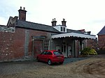
Upper Layham
Babergh DistrictSuffolk geography stubsVillages in Suffolk

Upper Layham is a village on the B1070 road, in the civil parish of Layham, in the Babergh district, in the county of Suffolk, England. Upper Layham has a post office and a pub. It is located to the east of the smaller village of Lower Layham. However, pedestrians/cyclists travelling from Upper Layham can use the footbridge by Layham Mill to cross the river Brett, and follow the path and lane leading to the Village Hall and St. Andrews Church.
Excerpt from the Wikipedia article Upper Layham (License: CC BY-SA 3.0, Authors, Images).Upper Layham
Gardeners Close, Babergh
Geographical coordinates (GPS) Address Nearby Places Show on map
Geographical coordinates (GPS)
| Latitude | Longitude |
|---|---|
| N 52.027 ° | E 0.964 ° |
Address
Gardeners Close
Gardeners Close
IP7 5JT Babergh
England, United Kingdom
Open on Google Maps


