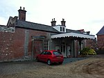
Layham
Babergh DistrictCivil parishes in SuffolkSuffolk geography stubsVillages in Suffolk

Layham is a small village and a civil parish in southern Suffolk, England, situated between the town of Hadleigh and the neighbouring village of Raydon. The civil parish contains the villages of Upper Layham and Lower Layham, separated by the River Brett. It is part of the Babergh district and falls within the South Suffolk parliamentary constituency. It has a church, St Andrews, and a public house, The Queen's Head, which are both situated in Lower Layham. More information on these and other aspects of Layham appear on the Parish Council's web site.
Excerpt from the Wikipedia article Layham (License: CC BY-SA 3.0, Authors, Images).Layham
The Street, Babergh
Geographical coordinates (GPS) Address Nearby Places Show on map
Geographical coordinates (GPS)
| Latitude | Longitude |
|---|---|
| N 52.028 ° | E 0.966 ° |
Address
The Street
The Street
IP7 5LA Babergh
England, United Kingdom
Open on Google Maps


