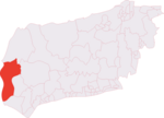
Westbourne, West Sussex
Chichester DistrictVillages in West Sussex

Westbourne is a village, civil parish and electoral ward in the Chichester District of West Sussex, England. It is located 0.5 miles (0.80 km) north east of Emsworth. The parish includes the hamlets of Woodmancote and Aldsworth, and once included the settlements of Southbourne and Prinsted to the south.
Excerpt from the Wikipedia article Westbourne, West Sussex (License: CC BY-SA 3.0, Authors, Images).Westbourne, West Sussex
The Grove, Chichester Westbourne
Geographical coordinates (GPS) Address Nearby Places Show on map
Geographical coordinates (GPS)
| Latitude | Longitude |
|---|---|
| N 50.8614 ° | E -0.9263 ° |
Address
The Grove
The Grove
PO10 8UE Chichester, Westbourne
England, United Kingdom
Open on Google Maps


