Horsebridge
Hampshire geography stubsTest ValleyUse British English from November 2020Villages in Hampshire

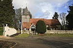
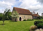
Horsebridge is a small village in the civil parish of King's Somborne in the Test Valley district of Hampshire, England. Its nearest town is Stockbridge, which lies approximately 3.6 miles (5.2 km) north-east from the village. The village has one pub, named the John O'Gaunt Inn.The village formerly had its own railway station, which ran between Romsey and Andover on the Sprat and Winkle Line, but this was closed down in 1962.
Excerpt from the Wikipedia article Horsebridge (License: CC BY-SA 3.0, Authors, Images).Horsebridge
Romsey Road, Test Valley
Geographical coordinates (GPS) Address Nearby Places Show on map
Geographical coordinates (GPS)
| Latitude | Longitude |
|---|---|
| N 51.0667 ° | E -1.5 ° |
Address
Romsey Road
Romsey Road
SO20 6PT Test Valley
England, United Kingdom
Open on Google Maps


