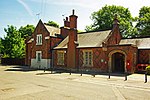
Fryerning

Fryerning is a small village and former civil parish, now in the parish of Ingatestone and Fryerning, which is situated approximately 1+1⁄2 miles (2.4 km) north of Ingatestone in Essex, England. The parish church of St. Mary the Virgin, on Blackmore Road, dates back from the 11th century, with a 15th-century brick tower. It has a memorial stained glass window to the murdered politician Airey Neave, which was unveiled by his cousin Penelope in 1985. An ancient English Yew, found to the west of the church and is over a millennium old, is thought to be one of Essex's oldest trees. In 1881, the parish had a population of 704.Fryerning is located in mid-Essex and has several big areas of woodland populated by several large herds of deer, which are frequently seen by walkers and cyclists.The village has no shops, but two pubs: The Cricketers and The Viper; the latter becomes particularly busy during its biannual beer festivals.
Excerpt from the Wikipedia article Fryerning (License: CC BY-SA 3.0, Authors, Images).Fryerning
Blackmore Road, Essex
Geographical coordinates (GPS) Address Nearby Places Show on map
Geographical coordinates (GPS)
| Latitude | Longitude |
|---|---|
| N 51.6748 ° | E 0.3705 ° |
Address
Blackmore Road
Blackmore Road
CM4 0NL Essex, Ingatestone and Fryerning
England, United Kingdom
Open on Google Maps


