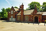
Ingatestone and Fryerning
Borough of BrentwoodCivil parishes in Essex

Ingatestone and Fryerning is a civil parish in the Brentwood borough of Essex, England. The parish includes the villages of Ingatestone and Fryerning, and covers an area of 3,917 acres (15.85 km2).
Excerpt from the Wikipedia article Ingatestone and Fryerning (License: CC BY-SA 3.0, Authors, Images).Ingatestone and Fryerning
Blackmore Road, Essex
Geographical coordinates (GPS) Address Nearby Places Show on map
Geographical coordinates (GPS)
| Latitude | Longitude |
|---|---|
| N 51.676388888889 ° | E 0.36472222222222 ° |
Address
Blackmore Road
CM4 0NW Essex, Ingatestone and Fryerning
England, United Kingdom
Open on Google Maps


