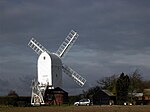
High Easter
Civil parishes in EssexUse British English from January 2018UttlesfordVillages in Essex

High Easter is a village and a civil parish in the Uttlesford district of Essex, England. The village is 7 miles (11 km) northwest from the city of and county town of Chelmsford. The parish includes the hamlets of Bishop's Green and Stagden Cross. Parsonage Brook, at 450 yards (400 m) north from the village flows northeast to southwest, meeting at the west of the parish the River Can, whose chief source is at the north, 2.5 miles (4.0 km) from the village, near Bishop's Green. High Easter is part of 'The Easters', an area adjacent to The Rodings. The population of the parish at the 2011 Census was 754.
Excerpt from the Wikipedia article High Easter (License: CC BY-SA 3.0, Authors, Images).High Easter
The Street, Uttlesford High Easter
Geographical coordinates (GPS) Address Nearby Places Show on map
Geographical coordinates (GPS)
| Latitude | Longitude |
|---|---|
| N 51.8071 ° | E 0.348399 ° |
Address
The Street
CM1 4QS Uttlesford, High Easter
England, United Kingdom
Open on Google Maps


