Gay City State Park
1944 establishments in ConnecticutFormer populated places in Tolland County, ConnecticutGhost towns in ConnecticutHebron, ConnecticutParks in Tolland County, Connecticut ... and 3 more
Protected areas established in 1944State parks of ConnecticutUse mdy dates from July 2023

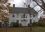
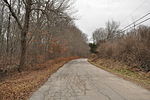
Gay City State Park is a public recreation area on the Blackledge River in the towns of Hebron and Bolton, Connecticut. The state park occupies 1,569 acres (635 ha) bordering Meshomasic State Forest and is accessible from State Route 85. In addition to its deep forest, millpond, and marshland, the park bears trace remnants (foundations, stone walls, and ditches) of the mill town that occupied the site for most of the 19th century. The park is managed by the Connecticut Department of Energy and Environmental Protection.
Excerpt from the Wikipedia article Gay City State Park (License: CC BY-SA 3.0, Authors, Images).Gay City State Park
Geographical coordinates (GPS) Address External links Nearby Places Show on map
Geographical coordinates (GPS)
| Latitude | Longitude |
|---|---|
| N 41.726111111111 ° | E -72.44 ° |
Address
Gay City State Park
06043
Connecticut, United States
Open on Google Maps


