Aldington, Kent
Civil parishes in Ashford, KentOpenDomesdayVillages in KentVillages in the Borough of Ashford

Aldington is a village and civil parish in the Ashford District of Kent, England. The village centre is eight miles (12 km) south-east of the town of Ashford. As with the village centre, set on a steep escarpment above agricultural Romney Marsh and the upper Stour is Aldington Knoll, which was used as a Roman burial barrow and later beacon, it has a panorama towards the English Channel and of low land such as Dungeness. At the 2021 Census the population included Bonnington.
Excerpt from the Wikipedia article Aldington, Kent (License: CC BY-SA 3.0, Authors, Images).Aldington, Kent
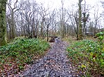
Roman Road,
Geographical coordinates (GPS) Address Nearby Places Show on map
Geographical coordinates (GPS)
| Latitude | Longitude |
|---|---|
| N 51.093611 ° | E 0.941111 ° |
Address
Roman Road
Roman Road
TN25 7DA , Aldington
England, United Kingdom
Open on Google Maps


