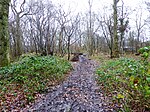
Bonnington

Bonnington is a dispersed village and civil parish on the northern edge of the Romney Marsh in Ashford District of Kent, England. The village is located eight miles (13 km) to the south of the town of Ashford on the B2067 (Hamstreet to Hythe road). Bonnington has under 100 inhabitants and has historic connections with smuggling. The parish used to boast its own school at the T-junction with the former B2069, and a public house (The Oak) located nearly two miles southeast of the village. The parish church, dedicated to St Rumwold, the child saint, is about half a mile to the south of the hamlet, on the Royal Military Canal. The parish council is now linked with the larger village of Aldington (where the population is now included) which is where the nearest shops can be found.
Excerpt from the Wikipedia article Bonnington (License: CC BY-SA 3.0, Authors, Images).Bonnington
Geographical coordinates (GPS) Address Nearby Places Show on map
Geographical coordinates (GPS)
| Latitude | Longitude |
|---|---|
| N 51.080277777778 ° | E 0.93222222222222 ° |
Address
TN25 7BA , Bonnington
England, United Kingdom
Open on Google Maps


