place

Army Flying Museum

Aerospace museums in EnglandAndover, HampshireArmy Air Corps (United Kingdom)Army museums in EnglandMilitary aviation museums in England
Museums in HampshireUse British English from September 2017
Museum of army flying gallery

The Army Flying Museum, previously known as the Museum of Army Flying, is a British military aviation museum about the history of flying in the British Army. It is located beside the Army Air Corps Centre in Middle Wallop, close to Andover in Hampshire, England.

Excerpt from the Wikipedia article Army Flying Museum (License: CC BY-SA 3.0, Authors, Images).

Army Flying Museum
A343, Test Valley Over Wallop

Geographical coordinates (GPS) Address External links Nearby Places
placeShow on map

Wikipedia: Army Flying MuseumContinue reading on Wikipedia

Geographical coordinates (GPS)

Latitude Longitude
N 51.1502 ° E -1.5726 °
placeShow on map

Address

Museum of Army Flying

A343
SO20 8FB Test Valley, Over Wallop
England, United Kingdom
mapOpen on Google Maps

linkWikiData (Q6940754)
linkOpenStreetMap (122623981)

Museum of army flying gallery
Share experience

Nearby Places

Nether Wallop
Nether Wallop

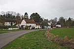
Nether Wallop is a village and civil parish in the Test Valley district of Hampshire, England. It is located approximately 3.7 miles (6 km) northwest of Stockbridge, and approximately 7 miles (11 km) southwest of Andover. Nether Wallop is the easternmost of the three villages collectively known as The Wallops, the other two being Over Wallop and Middle Wallop. The name "Wallop" derives from the Old English words waella and hop, which taken together roughly mean "the valley of springing water". The village was the site of the Battle of Guoloph that took place around AD 440. The element 'Wallop' is first attested in the Domesday Book of 1086 as 'Wallope', while Nether Wallop is first attested as 'Wollop inferior' c. 1270 in Episcopal Registers.Nether Wallop contains many old thatched cottages, and has been featured in books and TV programmes as one of the prettiest villages in England. In particular, Dane Cottage in Five Bells Lane was used as Miss Marple's home in the village of St. Mary Mead for the BBC TV adaptations of the Agatha Christie novels. The house and many of the surrounding lanes within the village were used as the setting and are commonly seen throughout many of the Miss Marple films. Sir Richard Reade (1511–1575), Lord Chancellor of Ireland, was a native of Nether Wallop, where his family were Lords of the Manor for several generations. The conductor Leopold Stokowski died at his home in Nether Wallop on 13 September 1977. The church of St Andrew is partly Anglo-Saxon, and unique fragments of frescoes apparently dating to the late Anglo-Saxon period have been discovered.For more than 200 years one of the two village pubs, The Five Bells, was a place to meet, eat and enjoy alcohol. For a few it was the centre of the village; a social hub along with the uniquely quaint village hall. Over the last two decades it has had a number of tenants and managers who were unable to make a success of the business. It finally closed in 2013 when the most recent tenant surrendered his lease early citing a lack of local support for the pub. The Nether Wallop Parish Council had it listed as a Community Asset that year. Whilst it remains closed the village has formed a Community Benefit Society, and sufficient pledged finance, to buy it at its current market value, but have so far failed to provide the owners with evidence of the availability of the funds for their proposed purchase .

Grateley
Grateley

Grateley is a village and civil parish in the north west of Hampshire, England. The name is derived from the Old English grēat lēah, meaning 'great wood or clearing'.The village is divided into two distinct settlements, 0.75 miles (1.21 km) apart: the old village and a newer settlement built around the railway station on the West of England Main Line. The hamlet of Palestine adjoins the railway station settlement, although it is located in the civil parish of Over Wallop.Grateley lies just to the south of the prehistoric hill fort of Quarley Hill. The parish covers 1,551 acres (6.28 km2) with 616 people living in 250 dwellings. The village has one pub, a thirteenth-century church dedicated to St Leonard, a primary school, a school for children with Asperger syndrome, a railway station, a small business park, a golf driving range, and is surrounded by farmland with ancient footpaths and droveways. King Æthelstan issued his first official law code in Grateley in about 930 AD. Recorded in the early 12th century Quadripartitus text, which referred to a ‘great assembly at Grateley’ (magna synodo apud Greateleyam). The legestaive assembly and construct of the Grateley law code acted as a manifestation of the peripatetic nature of Anglo-Saxon kingship.In the 20th century Grateley was one of many ammunition dumps during the World Wars.The economic history of Grateley is agricultural, but less than 10% of the village population now rely upon agriculture as an occupation.