Whitfield, Kent
Business parks of EnglandCivil parishes in KentDover DistrictEngvarB from June 2016Villages in Kent
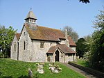
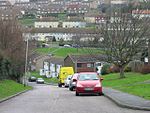
Whitfield is a village, civil parish and electoral ward in the English county of Kent. It now forms part of the urban area of the town of Dover. It has a modern counterpart in the large settlement located at the junction of the A2 and A256 roads, some four miles (6.4 km) north of Dover.
Excerpt from the Wikipedia article Whitfield, Kent (License: CC BY-SA 3.0, Authors).Whitfield, Kent
Honeywood Close,
Geographical coordinates (GPS) Address Nearby Places Show on map
Geographical coordinates (GPS)
| Latitude | Longitude |
|---|---|
| N 51.1533 ° | E 1.2946 ° |
Address
Honeywood Close
CT16 3NY , Whitfield
England, United Kingdom
Open on Google Maps


