Rogoredo
Districts of Milan

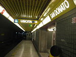
Rogoredo (Rogored in Lombard) is a former municipality, currently border district ("quartiere") of the city of Milan, Italy. It is part of the Zone 4 administrative division, and it is located 6–7 km south-east of the city centre. It borders on the Nosedo district to the east, on the Morsenchio district to the north, on the piazzale Corvetto neighbourhood to the north-west, and on the San Donato Milanese comune to the south-east. The name derives from the medieval Latin word robur, meaning "sessile oak, and stands for "oak wood".
Excerpt from the Wikipedia article Rogoredo (License: CC BY-SA 3.0, Authors, Images).Rogoredo
Via Monte Cengio, Milan Municipio 4
Geographical coordinates (GPS) Address Nearby Places Show on map
Geographical coordinates (GPS)
| Latitude | Longitude |
|---|---|
| N 45.431666666667 ° | E 9.2447222222222 ° |
Address
La cartogiochi
Via Monte Cengio
20138 Milan, Municipio 4
Lombardy, Italy
Open on Google Maps


