place

Abzucht

Rivers of GermanyRivers of Lower SaxonyRivers of the HarzTributaries of the Oker
Abzucht Goslar
Abzucht Goslar

The Abzucht, also known in its upper reaches as the Wintertalbach, is a 12.1-kilometre (7.5 mi) long, orographically left-hand, tributary of the Oker in Lower Saxony, Germany. The stream flows through the town of Goslar.

Excerpt from the Wikipedia article Abzucht (License: CC BY-SA 3.0, Authors, Images).

Geographical coordinates (GPS)

Latitude Longitude
N 51.85425 ° E 10.39635 °
placeShow on map

Address

Schalker Weg

Schalker Weg
38644
Lower Saxony, Germany
mapOpen on Google Maps

Abzucht Goslar
Abzucht Goslar
Share experience

Nearby Places

Schalke (Harz)
Schalke (Harz)

The Schalke is a mountain, 762 m above sea level (NN), in the Upper Harz in the German state of Lower Saxony. It lies in Goslar district north of Clausthal-Zellerfeld and west of Schulenberg. From 1959 there was a French listening post on the summit, which was supplemented in 1968 by a 64 m high concrete tower. This tower stood empty from 1993 and was demolished on 11 October 2002; the entire facility being removed in September 2003. Other listening posts in the Harz were located on the Wurmberg and the Stöberhai. Towers that still exist include those on the Ravensberg and the Bocksberg, the latter not far from the Schalke. The observation tower, which was about 10.5 m high, stood about 50 metres southeast of the listening post until 2002 and, following the demolition of the latter, was moved back to its original site on the summit. However it only has good views towards the east and south. The view extends from the Brocken past the Wurmberg and Hanskühnenburg to Clausthal-Zellerfeld. Next to the tower stands a shooting hut belonging to the Harz Club and stamp checkpoint no. 125 which is part of the Harzer Wandernadel hiking trail network. The tower is the oldest (built 1892, restored 1992) of four steel observation towers belonging to the Harzklub in the Harz. A road, closed to private cars, runs from the Auerhahn Inn on the B 241 federal highway up to the Schalke. There are also long hiking trails from Zellerfeld and Goslar and a short, steep footpath from Mittelschulenberg past the Lower Schalke Pond and Festenburg, two parishes in Schulenberg, up to the Schalke.

Zwinger (Goslar)
Zwinger (Goslar)

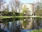
The Zwinger in Goslar is a battery tower that is part of the fortifications of the old imperial city of Goslar, Germany. It is located on the Thomaswall in the south of the town and was built in 1517. On this side Goslar was strongly dominated by the nearby hill of Rammelsberg, which would have made a good location for positioning enemy guns in the event of an attack on the town; the town fortifications therefore needed the extra protection of a strong battery tower at this point. The stonework of Goslar's Zwinger was predominantly made of sandstone quarried from the Sudmerberg northeast of Goslar and mortared with burnt lime. Because lime burning was still in not fully developed, the builders mixed the mortar with horsehair, quark, goat's milk and ox blood to harden it fully. Immediately under the corbelling are two sandstone tablets in the wall bearing the coats of arms of the German Empire and the town of Goslar and the inscription "Anno dm M D X V II". The original conical roof was dismantled in 1857. With a wall thickness at the base of 6.5 metres, a diameter of 26 metres and a height of 20 metres, the Zwinger is one of the strongest surviving and utilised defensive towers in Europe. The Goslar Zwinger has been privately owned since 1 August 1936. Today it houses a restaurant on the ground floor, three holiday apartments on the middle floor and a small museum of medieval weapons, armour and torture implements on the top floor.