place

Upper Harz

HarzMountains of the HarzPages with German IPA
Clausthal 2012 028
Clausthal 2012 028

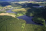
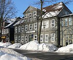
The Upper Harz (German: Oberharz, pronounced [ˈoːbɐhaːɐ̯ts]) refers to the northwestern and higher part of the Harz mountain range in Germany. The exact boundaries of this geographical region may be defined differently depending on the context. In its traditional sense, the term Upper Harz covers the area of the seven historical mining towns (Bergstädte) - Clausthal, Zellerfeld, Andreasberg, Altenau, Lautenthal, Wildemann and Grund - in the present-day German federal state of Lower Saxony. Orographically, it comprises the Harz catchment areas of the Söse, Innerste and Grane, Oker and Abzucht mountain streams, all part of the larger Weser watershed. Much of the Upper Harz area is up to 700 metres (2,300 ft) above sea level. In a wider sense, it also comprises the adjacent High Harz (Hochharz) range in the east, climbing to over 1,100 m (3,600 ft) in the Brocken massif.

Excerpt from the Wikipedia article Upper Harz (License: CC BY-SA 3.0, Authors, Images).

Upper Harz
Mönchstalweg, Harz (LK Goslar)

Geographical coordinates (GPS) Address Nearby Places
placeShow on map

Wikipedia: Upper HarzContinue reading on Wikipedia

Geographical coordinates (GPS)

Latitude Longitude
N 51.816666666667 ° E 10.366666666667 °
placeShow on map

Address

Mönchstalweg

Mönchstalweg
38707 Harz (LK Goslar)
Lower Saxony, Germany
mapOpen on Google Maps

Clausthal 2012 028
Clausthal 2012 028
Share experience

Nearby Places

Upper Harz Water Regale

The Upper Harz Water Regale (German: Oberharzer Wasserregal, pronounced [ˌoːbɐhaːɐ̯tsɐ ˈvasɐʁeɡaːl]) is a system of dams, reservoirs, ditches and other structures, much of which was built from the 16th to 19th centuries to divert and store the water that drove the water wheels of the mines in the Upper Harz region of Germany. The term regale, here, refers to the granting of royal privileges or rights (droit de régale) in this case to permit the use of water for mining operations in the Harz mountains of Germany. The Upper Harz Water Regale is one of the largest and most important historic mining water management systems in the world. The facilities developed for the generation of water power have been placed under protection since 1978 as cultural monuments. The majority are still used, albeit nowadays their purpose is primarily to support rural conservation (the preservation of a historic cultural landscape), nature conservation, tourism and swimming. From a water management perspective, several of the reservoirs still play a role in flood protection and the supply of drinking water. On 31 July 2010 the Regale was declared a UNESCO World Heritage Site affiliated with the Mines of Rammelsberg and the Historic Town of Goslar because of its importance in the development of mining techniques and testimony to the medieval history of ore mining.The water system covers an area of roughly 200 square kilometres (77 sq mi) within the Lower Saxon part of the Harz, the majority of structures being found in the vicinity of Clausthal-Zellerfeld, Hahnenklee, Sankt Andreasberg, Buntenbock, Wildemann, Lautenthal, Schulenberg, Altenau and Torfhaus.

Schalke (Harz)
Schalke (Harz)

The Schalke is a mountain, 762 m above sea level (NN), in the Upper Harz in the German state of Lower Saxony. It lies in Goslar district north of Clausthal-Zellerfeld and west of Schulenberg. From 1959 there was a French listening post on the summit, which was supplemented in 1968 by a 64 m high concrete tower. This tower stood empty from 1993 and was demolished on 11 October 2002; the entire facility being removed in September 2003. Other listening posts in the Harz were located on the Wurmberg and the Stöberhai. Towers that still exist include those on the Ravensberg and the Bocksberg, the latter not far from the Schalke. The observation tower, which was about 10.5 m high, stood about 50 metres southeast of the listening post until 2002 and, following the demolition of the latter, was moved back to its original site on the summit. However it only has good views towards the east and south. The view extends from the Brocken past the Wurmberg and Hanskühnenburg to Clausthal-Zellerfeld. Next to the tower stands a shooting hut belonging to the Harz Club and stamp checkpoint no. 125 which is part of the Harzer Wandernadel hiking trail network. The tower is the oldest (built 1892, restored 1992) of four steel observation towers belonging to the Harzklub in the Harz. A road, closed to private cars, runs from the Auerhahn Inn on the B 241 federal highway up to the Schalke. There are also long hiking trails from Zellerfeld and Goslar and a short, steep footpath from Mittelschulenberg past the Lower Schalke Pond and Festenburg, two parishes in Schulenberg, up to the Schalke.

Polsterberg Pumphouse

The Polsterberg Pumphouse (German: Polsterberger Hubhaus) is a pumping station above the Dyke Ditch in the Upper Harz in central Germany which is used today as a forest restaurant. As part of the Upper Harz Water Regale it was built in the 18th century and was used to lift the water needed in Clausthal for the mining industry from the Dyke Ditch (Dammgraben) to the level of the highest pond, the Hirschler Pond. Aside from this water hoist, the Dyke Ditch supplied, and still supplies, water over ditches and tunnels to the Hausherzberg Ponds and the Lower Peacock Pond (Unterer Pfauenteich). The problem was however, that, as it happened, the most productive silver mines in the Upper Harz mining region, the Caroline Pit and the Dorothea Pit, were high up in the mountains and could only be supplied with water power from the Hirschler Pond. The motive force for the wooden piston pumps was won in the Polster valley below by two water wheels. The headrace for these water wheels was brought via the Heller Valley Ditch (Hellertal Graben) from the Heller valley and from the Fortune Pond over its Bottom Ditch (Grundgraben), but frictional losses and poor efficiencies meant that a considerable amount of headrace water was required in order to lift just a few litres of water from the Dyke Ditch. These wheels transferred their output power over 260 and 560 m long flat rods made of wood to the pumping station on the Polsterberg hill. In the pumping station the water from the Dyke Ditch was pumped 8 m higher and fed into drinking troughs from which it was then further transported via the Hutthal Ditch and Huttaler Widerwaage to the Hirschler Pond, or via the Jägersbleek Tunnel and Ditch. The Polsterberg Pumphouse also acted as living accommodation for the master pumper and the ditch keepers, as well as a bar (Schankstube). At the beginning of the 20th century the wooden structures were replaced by electrically-drive pumps; the original can still be seen in the pumphouse by the ditch. Today the building is listed. It is purely run as a restaurant and is a popular destination for walkers from Altenau and Clausthal-Zellerfeld. Like the nearby Sperberhai Dam House it lies on the Harz High Road, the B 242.