place

Schulenberg im Oberharz

Goslar (district)Goslar district geography stubsPages with German IPA
SchulenbergWeisswasser

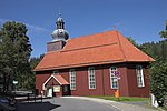
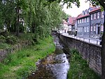
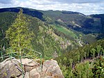
Schulenberg im Oberharz (German pronunciation: [ˌʃuːlənbɛʁk ʔɪm ˈʔoːbɐhaːɐ̯ts]) is a village and a former municipality in the district of Goslar in Lower Saxony, Germany. It has been part of the town Clausthal-Zellerfeld since January 1, 2015.

Excerpt from the Wikipedia article Schulenberg im Oberharz (License: CC BY-SA 3.0, Authors, Images).

Schulenberg im Oberharz
Wiesenbergstraße,

Geographical coordinates (GPS) Address Nearby Places
placeShow on map

Wikipedia: Schulenberg im OberharzContinue reading on Wikipedia

Geographical coordinates (GPS)

Latitude Longitude
N 51.836111111111 ° E 10.435 °
placeShow on map

Address

Wiesenbergstraße
38707 (Bergstadt Altenau - Schulenberg i.O.)
Lower Saxony, Germany
mapOpen on Google Maps

SchulenbergWeisswasser
Share experience

Nearby Places

Polsterberg Pumphouse

The Polsterberg Pumphouse (German: Polsterberger Hubhaus) is a pumping station above the Dyke Ditch in the Upper Harz in central Germany which is used today as a forest restaurant. As part of the Upper Harz Water Regale it was built in the 18th century and was used to lift the water needed in Clausthal for the mining industry from the Dyke Ditch (Dammgraben) to the level of the highest pond, the Hirschler Pond. Aside from this water hoist, the Dyke Ditch supplied, and still supplies, water over ditches and tunnels to the Hausherzberg Ponds and the Lower Peacock Pond (Unterer Pfauenteich). The problem was however, that, as it happened, the most productive silver mines in the Upper Harz mining region, the Caroline Pit and the Dorothea Pit, were high up in the mountains and could only be supplied with water power from the Hirschler Pond. The motive force for the wooden piston pumps was won in the Polster valley below by two water wheels. The headrace for these water wheels was brought via the Heller Valley Ditch (Hellertal Graben) from the Heller valley and from the Fortune Pond over its Bottom Ditch (Grundgraben), but frictional losses and poor efficiencies meant that a considerable amount of headrace water was required in order to lift just a few litres of water from the Dyke Ditch. These wheels transferred their output power over 260 and 560 m long flat rods made of wood to the pumping station on the Polsterberg hill. In the pumping station the water from the Dyke Ditch was pumped 8 m higher and fed into drinking troughs from which it was then further transported via the Hutthal Ditch and Huttaler Widerwaage to the Hirschler Pond, or via the Jägersbleek Tunnel and Ditch. The Polsterberg Pumphouse also acted as living accommodation for the master pumper and the ditch keepers, as well as a bar (Schankstube). At the beginning of the 20th century the wooden structures were replaced by electrically-drive pumps; the original can still be seen in the pumphouse by the ditch. Today the building is listed. It is purely run as a restaurant and is a popular destination for walkers from Altenau and Clausthal-Zellerfeld. Like the nearby Sperberhai Dam House it lies on the Harz High Road, the B 242.

Kästeklippen
Kästeklippen

The Kästeklippen, often shortened to Käste, is a rocky tor above the Oker valley in the Upper Harz mountains of central Germany. It lies at a height of 602 m above NN. Near the Käste are other similar granite rock formations such as the Hexenküche ("Witch's Kitchen"), Mausefalle ("Mousetrap"), Feigenbaumklippe and the Treppenstein. Next to the observation platform is a protruding rock which resembles the face of an old man and is called Der Alte vom Berge ("Old Man of the Mountain"). The rocks consist of granite "wool sacks", typical of the Harz region. The Kästeklippen (Klippen = crags) are a popular destination in the Harz. From here, there are views to the Sudmerberg hill in the borough of Goslar. Numerous paths lead from the Oker Reservoir, Romkerhall, Oker, Göttingerode and Bad Harzburg up to the Käste. The most important access route is the Kästestraße. It runs from Bad Harzburg up to the Schlackenplatz on the Morlberg and then continues at a height of just under 600 m over the Alte Schlewecke and the crags of the Stiefmutterklippen to the Käste. From there it goes downhill again, past the Hinterer Ziegenrücken and Vorderen Ziegenrücken to Oker. The Kästestraße was once tarmacked all the way from Bad Harzburg to the Käste. Remnants of the asphalt surface can still be seen today. From the beginning of April to the end of October a bus service runs from Bad Harzburg to the Käste. The Kästehaus restaurant was demolished in 2019. The Kästehaus is checkpoint no. 118 in the Harzer Wandernadel hiking trail network.