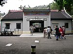
Tai Po District

Tai Po District is one of the 18 districts of Hong Kong. The suburban district covers the areas of Tai Po New Town (including areas such as Tai Po Market, Tai Po Old Market, Tai Po Industrial Estate, Tai Wo Estate), Tai Po Tau, Tai Po Kau, Hong Lok Yuen, Ting Kok, Plover Cove, Lam Tsuen Valley, Tai Mei Tuk and other surrounding areas, and its exclaves Sai Kung North, in the northern part of the Sai Kung Peninsula and including islands such as Grass Island (Tap Mun), and Ping Chau (Tung Ping Chau). Tai Po proper and Sai Kung North are divided by the Tolo Channel and the Tolo Harbour (Tai Po Hoi). The district is located in the Eastern New Territories. The de facto administrative centre of the district is Tai Po New Town. Like Yuen Long, the area of Tai Po used to be a traditional market town. Tai Po New Town, a satellite town, developed around the area of Tai Po and on reclaimed land on the estuaries of Lam Tsuen and Tai Po rivers. It had a population of 310,879 in 2001. The district has the third lowest population density in Hong Kong.
Excerpt from the Wikipedia article Tai Po District (License: CC BY-SA 3.0, Authors, Images).Tai Po District
Ting Kok Road, Tai Po District Tai Po Market
Geographical coordinates (GPS) Address Nearby Places Show on map
Geographical coordinates (GPS)
| Latitude | Longitude |
|---|---|
| N 22.45085 ° | E 114.16422 ° |
Address
大埔政府合署 Tai Po Government Offices
Ting Kok Road
Tai Po District, Tai Po Market
Hong Kong, China
Open on Google Maps


