place

Highwood, Essex

City of ChelmsfordCivil parishes in EssexEssex geography stubsVillages in Essex
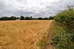
Footpath, Highwood, Essex geograph.org.uk 79333

Highwood is a village and civil parish in the Chelmsford district of Essex, England. The village is approximately a mile south from the A414 road and four miles west from the centre of the county town of Chelmsford. Loves Green is part of the village at its north. The hamlet of Edney Common is at the east of the parish. In 2011 the parish had a population of 654.

Excerpt from the Wikipedia article Highwood, Essex (License: CC BY-SA 3.0, Authors, Images).

Highwood, Essex
Highwood Road, Chelmsford Highwood

Geographical coordinates (GPS) Address Phone number Website Nearby Places
placeShow on map

Wikipedia: Highwood, EssexContinue reading on Wikipedia

Geographical coordinates (GPS)

Latitude Longitude
N 51.7105 ° E 0.3739 °
placeShow on map

Address

Highwood Primary School

Highwood Road
CM1 3QH Chelmsford, Highwood
England, United Kingdom
mapOpen on Google Maps

Phone number

call+441245248200

Website
highwood.essex.sch.uk

linkVisit website

Footpath, Highwood, Essex geograph.org.uk 79333
Share experience

Nearby Places

Forest of Essex
Forest of Essex

The Forest of Essex was a royal forest that existed from around 1100 and was disestablished in the 13th century. Forests were legal institutions introduced by the Normans to denote an area where the King or another magnate had the right to keep and hunt deer and make Forest Law. Initially there was a very weak correlation between the extent of the legal forest and what might be termed the 'physical forest', the often wooded common land areas where the deer lived. In later centuries there was a much stronger correlation, so much so that the word forest is now taken to mean the same as woodland. The Forest of Essex covered nearly all of the traditional extent of Essex, but that is not to say the majority of Essex was wooded. The naturalist Oliver Rackham carried out an analysis of Domesday returns for Essex and was able to estimate the county was 20% wooded in 1086. The area covered by Forest Law excluded the least wooded areas of the county along the Thames and North Sea coasts so the percentage for the Forest of Essex was a little higher. Over time parts of the country were disafforested, removed from Forest Law. In 1204 the men of Essex paid the King 500 marks and five palfreys for the 'forest of Essex which is beyond the Causeway between Colchester and Bishop's Stortford to be disafforested. In 1327 Edward III confirmed the Charter of the Forest (originally granted by Edward I in 1304) removing most of the rest of the rest of the County from Forest Law, ending the Forest of Essex. Forest Law now applied only to royal manors and the heavily wooded areas in the south-west Essex.This disestablishment of the Forest of Essex led to the creation of four new smaller Forests which concentrated on areas with a greater proportion of woodland cover, namely: Waltham Forest (which included the physical forest areas subsequently known as Epping Forest, Wintry Forest (north of Epping) and Hainault Forest), Hatfield Forest, Writtle Forest and the long lost Kingswood Forest near Colchester. Hatfield and Writtle were royal manors while Kingswood was attached to the borough of Colchester, but the king owned the trees and grazing there.