place

Carroll Park Methodist Episcopal Church

19th-century Methodist church buildings in the United StatesBrooklyn building and structure stubsCarroll Gardens, BrooklynChurches completed in 1890Churches in Brooklyn
Closed churches in New York CityDemolished buildings and structures in BrooklynDemolished churches in New York CityGothic Revival church buildings in New York CityMethodist churches in New York CityNew York City church stubsNorwegian-American culture in New York (state)Victorian architecture in New York City

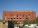
Carroll Park Methodist Episcopal Church is a former Methodist church in Brooklyn, New York, formerly located at 295 Carroll Street, Carroll Gardens, Brooklyn, New York City. The Victorian Gothic edifice was erected c.1890 and located within the Carroll Gardens historic district. It was reused as Norwegian Methodist Episcopal Church, reflecting the large Scandinavian population in Brooklyn between the 1890s and 1949. It was "sold in 1949 and reused as the South Brooklyn Christian Assembly Church but as of 1977, it was largely demolished and redeveloped into three townhouses with no evidence of the church remaining."

Excerpt from the Wikipedia article Carroll Park Methodist Episcopal Church (License: CC BY-SA 3.0, Authors).

Carroll Park Methodist Episcopal Church
Carroll Street, New York Brooklyn

Geographical coordinates (GPS) Address Nearby Places
placeShow on map

Wikipedia: Carroll Park Methodist Episcopal ChurchContinue reading on Wikipedia

Geographical coordinates (GPS)

Latitude Longitude
N 40.679686111111 ° E -73.993069444444 °
placeShow on map

Address

Carroll Street 297
11231 New York, Brooklyn
New York, United States
mapOpen on Google Maps

Share experience

Nearby Places

Carroll Gardens, Brooklyn

Carroll Gardens is a neighborhood in the northwestern portion of the New York City borough of Brooklyn. Taking up around 40 city blocks, it is bounded by Degraw and Warren Streets (north), Hoyt and Smith Streets (east), Ninth Street or the Gowanus Expressway (south), and Interstate 278, the Gowanus and Brooklyn–Queens Expressways (west). The neighborhoods that surround it are Cobble Hill to the northwest, Boerum Hill to the northeast, Gowanus to the east, Red Hook to the south and southwest, and the Columbia Street Waterfront District to the west.Originally considered to be part of the area once known as South Brooklyn (or, more specifically, Red Hook), the area started to have its own identity in the 1960s. The neighborhood was named after Charles Carroll, the only Roman Catholic signer of the Declaration of Independence, and whose name was already attached to Carroll Street and Carroll Park. The name also reflects the large front gardens of brownstones in the Carroll Gardens Historic District and elsewhere in the neighborhood. Despite having an Irish surname, in recent times it has been known as an Italian American neighborhood. Carroll Gardens is part of Brooklyn Community District 6, and its primary ZIP Code is 11231. It is patrolled by the 76th Precinct of the New York City Police Department. and is served by the New York City Fire Department's Engine Company 239, Engine Co. 279/Ladder Co. 131 and Engine Company 202/Ladder Company 101. Politically, Carroll Gardens is represented by the New York City Council's 39th District.